Sus, Pyrénées-Atlantiques facts for kids
Quick facts for kids
Sus
|
|
|---|---|

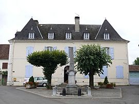
The town hall and school
|
|
| Country | France |
| Region | Nouvelle-Aquitaine |
| Department | Pyrénées-Atlantiques |
| Arrondissement | Oloron-Sainte-Marie |
| Canton | Le Cœur de Béarn |
| Intercommunality | Béarn des Gaves |
| Area
1
|
11.50 km2 (4.44 sq mi) |
| Population
(Jan. 2019)
|
377 |
| • Density | 32.78/km2 (84.91/sq mi) |
| Time zone | UTC+01:00 (CET) |
| • Summer (DST) | UTC+02:00 (CEST) |
| INSEE/Postal code |
64529 /64190
|
| Elevation | 118–263 m (387–863 ft) (avg. 164 m or 538 ft) |
| 1 French Land Register data, which excludes lakes, ponds, glaciers > 1 km2 (0.386 sq mi or 247 acres) and river estuaries. | |
Sus (which is Xütxe in the local Basque language) is a small town in the southwest of France. It is known as a commune, which is like a local district or municipality. Sus is part of the Pyrénées-Atlantiques area, which is a department (similar to a county). This department is located in the larger Nouvelle-Aquitaine region of France.
In 2019, about 377 people lived in Sus. The town is close to other places like Susmiou, Gurs, and Navarrenx.
Where is Sus Located?
Sus is found in the Oloron-Sainte-Marie arrondissement. This area is in the southern part of the Nouvelle-Aquitaine region.
The town is quite close to several other towns:
- It is about 1.4 kilometers (0.9 miles) from Susmiou.
- It is 1.8 kilometers (1.1 miles) from Navarrenx.
- It is 2.5 kilometers (1.6 miles) from Gurs.
- The larger city of Pau is about 32.1 kilometers (19.9 miles) away.
- Bayonne is further, at 60.8 kilometers (37.8 miles).
Sus is located to the west of the Gave d'Oloron river. On the other side of this river, you can find the town of Jasses.
Images for kids
Want to Learn More?
 In Spanish: Sus (Pirineos Atlánticos) para niños
- You can also learn more about other towns in the Pyrénées-Atlantiques department.

All content from Kiddle encyclopedia articles (including the article images and facts) can be freely used under Attribution-ShareAlike license, unless stated otherwise. Cite this article:
Sus, Pyrénées-Atlantiques Facts for Kids. Kiddle Encyclopedia.


