


.jpg)


- This page was last modified on 17 October 2025, at 11:18. Suggest an edit.
Sydney Metro City & Southwest facts for kids
| Sydney Metro City and Southwest | |
|---|---|
 |
|

The City and Southwest project (dotted) extends the Metro North West Line (shaded)
|
|
| Overview | |
| Status | Phase 1 complete, Phase 2 under construction |
| Owner | Transport for NSW |
| Line number | M1 |
| Locale | Sydney, New South Wales, Australia |
| Termini | Tallawong Sydenham |
| Stations | 18 (7 new stations, 11 stations converted) |
| Service | |
| Type | Rapid transit |
| System | Sydney Metro |
| Rolling stock | Metropolis Stock |
| History | |
| Opened | 19 August 2024 (Chatswood to Sydenham) |
| Announced | 2013 |
| Start of major construction | 2017 |
| Planned opening | 2026 (Sydenham to Bankstown) |
| Technical | |
| Line length | 30 km (19 mi) |
| Number of tracks | 2 |
| Track gauge | 1,435 mm (4 ft 8 1⁄2 in) standard gauge |
| Electrification | 1,500 V DC from overhead catenary |
| Signalling | Alstom Urbalis 400 moving block CBTC ATC under ATO GoA 4 (UTO), with subsystems of ATP, Iconis ATS and Smartlock CBI |
The Sydney Metro City and Southwest is a big train project in Sydney, Australia. It is about 30 kilometers (19 miles) long. This project makes the Metro Northwest and Bankstown Line longer. It connects Chatswood in the north to Bankstown in the southwest. The new line goes right through the middle of Sydney. It is a key part of the Sydney Metro train system.
This project has two main parts. First, there's a new 16-kilometer (10-mile) tunnel. This tunnel goes under Sydney Harbour and through the city. It has seven new underground stations. This makes it Australia's longest tunnel. The second part changes 11 stations on the old Bankstown railway line. These stations are now ready for driverless trains.
The first part of the project, from Chatswood to Sydenham, opened on 19 August 2024. The rest of the line, from Sydenham to Bankstown, is expected to open in 2026. When finished, the whole line will be 66 kilometers (41 miles) long. This project helps more than 100,000 extra people travel by train every hour. It also increases the train network's capacity by up to 60%.
Work on the project started in 2017. The total cost of the project is about $20.5 billion. This was more than first expected due to unexpected costs and changes to station designs.
Contents
Building the Metro: A Timeline
Early Ideas and Planning
In 2013, people started talking about making the train line longer. The idea was to build a metro tunnel from Chatswood. It would go under Sydney Harbour and through the city. Then it would connect to converted lines towards Bankstown. This plan was similar to an older idea called the CBD Rail Link.
The New South Wales government officially announced the project on 10 June 2014. They got the money for it in June 2015. Early work began on 9 April 2015. Workers drilled deep holes under Sydney Harbour. This helped them find the best path for the new tunnels.
Chatswood to Sydenham Section
This part of the project got approval in January 2017. In June 2017, a group of companies won the job to build the twin tunnels. These tunnels run from Chatswood to Sydenham. Construction started later that year.
A big upgrade for Central Station began in March 2018. This included building two new underground platforms for the metro. A new underground area called Central Walk was also built. Tunnelling for the metro started in October 2018 and finished in March 2020.
In November 2018, another contract was given out. This contract was for laying the tracks from Chatswood to Sydenham. It also included changing the power system on the Bankstown line. This was to make it ready for metro trains.
The Chatswood to Sydenham section opened on 19 August 2024.
Sydenham to Bankstown Section
From Sydenham, the Sydney Metro uses the existing Bankstown railway line. This section, between Sydenham and Bankstown, was changed for driverless trains. These trains have special doors at the platforms. Bankstown will be a station where you can change trains. You can switch between the M1 Metro line and the T6 Lidcombe & Bankstown line.
The plan to upgrade the Bankstown line was approved in December 2018. From December 2019, parts of the Bankstown line were closed at certain times. This allowed workers to convert the line to metro standards.
Some people had concerns about changing the Bankstown line. A report in April 2020 suggested the metro should stop at Sydenham. However, the government decided to continue with the conversion.
In December 2020, it was announced how train services would change. When the Bankstown line closed for conversion, a new service from Liverpool to the City would run. Also, a shuttle train would run between Lidcombe and Bankstown.
In April 2023, the government confirmed a delay in the Bankstown line conversion. It was then expected to open in 2025. In August 2023, the government confirmed the project would continue. The line between Sydenham and Bankstown would close for 12 months from September 2024 for the conversion work.
In September 2024, a union had concerns about working conditions. In March 2025, the Minister for Transport, John Graham, announced another delay. Due to these issues, the project is now expected to open in 2026. On 3 April 2025, the first test train ran on the Southwest section of the M1 metro line.
Project Costs

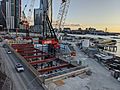
A tunnel boring machine being assembled at the Barangaroo station dive site in June 2019. Unexpected costs were mainly from building the underground stations.
In 2020, a report said the project's cost had increased. It was now expected to be $16.8 billion. The project was first estimated to cost between $11.5 and $12.5 billion. These increases were partly due to unexpected costs of building the underground stations in the city.
In April 2023, the new government reviewed the project. They announced that the City & Southwest project was budgeted to cost $20.5 billion. This was a $9 billion increase from the first plans.
Metro Route and Stations
.jpg)
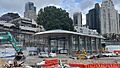
The first part of the extension now ends at Sydenham station, a major interchange.
This project is a big extension of the Metro Northwest and Bankstown Line. It connects Chatswood to Sydenham. New stations were built at Crows Nest, Victoria Cross, Barangaroo, Martin Place, Pitt Street (now Gadigal), Central, and Waterloo. At Sydenham, the new line joins the existing Bankstown railway line. This line was changed for driverless trains to run between Sydenham and Bankstown.
The original plan for stations included Crows Nest, Victoria Cross, Martin Place, Gadigal (Pitt Street), Central, Sydenham, and 10 stations on the Bankstown line. Later, Barangaroo and Waterloo stations were added. Other proposed stations were not included.
West of Bankstown, Sydney Trains still runs services. These are on the T6 Lidcombe & Bankstown Line. Services to St Peters and Erskineville, east of Sydenham, are now handled by other train lines.
Future Plans

Liverpool was once considered for a future extension of the line.
In November 2015, studies began for new train lines in Western Sydney. This included looking at a possible extension of the Sydney Metro City & Southwest. The idea was to extend it from Bankstown to Liverpool. However, after the 2023 NSW Government election, this Metro extension was cancelled.
Images for kids
-

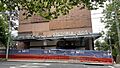
Gadigal railway station under construction in October 2018
-
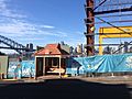
Construction at the Blues Point dive site, April 2019
-
Tunnel boring at the Waterloo station dive site, May 2019
-
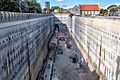
Construction of the underground interchange at Martin Place station, July 2019
-
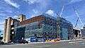
The Barangaroo station box under construction in September 2020
-
Victoria Cross station, November 2023
-
Crows Nest station, November 2023
-
Barangaroo station, November 2023
See also
- Transport in Sydney in the 2010s
- Metro Tunnel – a similar project in Melbourne
- Cross River Rail – a similar project in Brisbane
- City Rail Link – a similar project in Auckland, New Zealand