Tacoma Narrows facts for kids
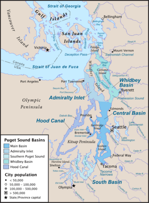
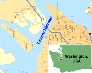
The Tacoma Narrows, also known simply as The Narrows, is a narrow body of water that is part of Puget Sound in the state of Washington, United States. It's like a natural channel or passage of water that connects two larger bodies of water. This important waterway separates the Kitsap Peninsula from the city of Tacoma.
The Narrows was formed by glaciers long ago, which carved out the land and created this deep channel. It's a very important path for ships and boats.
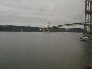
Today, the Tacoma Narrows is famous for the two large Tacoma Narrows Bridges that cross it. These bridges carry State Route 16, connecting people and places across the water. An earlier bridge here became famous for collapsing not long after it was built.
Contents
Naming the Tacoma Narrows
The name "Narrows" was first given to this strait in 1841 by Charles Wilkes. He was exploring the area as part of the United States Exploring Expedition. He simply called it "Narrows" because of how narrow the waterway is.
Later, in 1847, the name was officially set as "The Narrows" by Henry Kellett. He was working for the British Admiralty, which was creating new maps and charts of the area. This formal naming helped everyone use the same name for this important geographic feature.
The Tacoma Narrows Bridges
The Tacoma Narrows is well-known because of the bridges that cross it. There are actually two bridges side-by-side today. They are called the Tacoma Narrows Bridges.
The First Bridge: "Galloping Gertie"
The first bridge built across the Tacoma Narrows opened in 1940. It was a very modern bridge for its time. However, it had a big problem: it would sway and twist a lot in the wind. People even gave it the nickname "Galloping Gertie."
Just a few months after it opened, strong winds caused the bridge to twist and move so much that it broke apart and fell into the water. Luckily, no one was seriously hurt, but the collapse was a huge event that taught engineers a lot about bridge design.
The New Bridges
After the first bridge collapsed, a new bridge was built in its place. This second bridge opened in 1950 and was designed to be much stronger and more stable. It has stood safely ever since.
Because so many people needed to cross the Narrows, a third bridge was built right next to the 1950 bridge. This newer bridge opened in 2007. Now, the two bridges work together to carry traffic, making it easier for people to travel between the Kitsap Peninsula and Tacoma.
See also
 In Spanish: Estrecho de Tacoma para niños
 | William M. Jackson |
 | Juan E. Gilbert |
 | Neil deGrasse Tyson |


