Taddington Moor facts for kids
Quick facts for kids Taddington Moor |
|
|---|---|

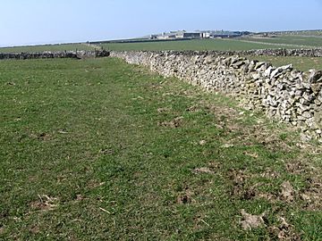
Footpath near Fivewells Farms
|
|
| Highest point | |
| Elevation | 438 metres (1,437 ft) |
| Geography | |
| Location | Peak District, England |
| OS grid | SK135705 |
| Topo map | OS Explorer OL24 |
Taddington Moor is a special limestone hill found in the Peak District in England. It sits between the villages of Taddington, Flagg, and Chelmorton. This area is a high farming landscape, meaning it's used for agriculture. The very top of the moor is called Sough Top, and it's about 438 meters (1,437 feet) above sea level.
Contents
Discovering Taddington Moor
Taddington Moor is not just a hill; it's also home to some very old and interesting historical sites. People have lived and traveled across this land for thousands of years.
Ancient Discoveries at Five Wells
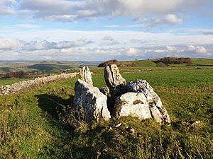
On Taddington Moor, you can find a place called Five Wells. This is a Neolithic chambered tomb. A chambered tomb is an ancient burial place made of large stones. It was built by people who lived here thousands of years ago, long before written history.
Five Wells is now a protected site called a scheduled ancient monument. This means it's very important and kept safe. An archaeologist named Thomas Bateman first dug into this tomb in 1846. He found the remains of at least twelve human skeletons inside its stone rooms.
Taddington High Mere: An Ice Age Pond
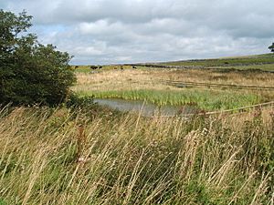
On the edge of Taddington Moor, there's an old pond called Taddington High Mere. This pond was formed a very long time ago, during the Ice Age. It's a rare and important source of water on the White Peak limestone plateau, where water can be hard to find.
People have known about this pond for centuries. In 1690, a person named John Orme wrote about it, calling it 'the great pond or meare called Taddington high Meare'. An old path for packhorses, called Oriss Road, used to pass right by the mere. In 2004, volunteers from Taddington village helped restore the mere, making sure it stays healthy.
Exploring Taddington Moor's Trails
Taddington Moor is a great place for walking and exploring. Several long-distance walking paths cross the moor. The Pennine Bridleway and the Midshires Way follow the same route, going north to south across the eastern part of the moor.
Another popular path is the Limestone Way. This long-distance footpath also runs north to south across the moor. It goes between the village of Flagg and The Waterloo pub, which is located on the A6 road. These trails allow people to enjoy the beautiful scenery and history of Taddington Moor.
 | Charles R. Drew |
 | Benjamin Banneker |
 | Jane C. Wright |
 | Roger Arliner Young |


