Taghum facts for kids
Quick facts for kids
Taghum
|
|
|---|---|
| Country | |
| Province | BC/BCE |
| Region | West Kootenay |
| Regional District | Central Kootenay |
| Area codes | 250, 778, 236, & 672 |
| Highways | |
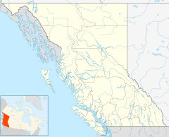
Taghum is a small community in southeastern British Columbia, Canada. It's located in the West Kootenay region. The community sits on both sides of the Kootenay River. You can find Taghum along BC Highway 6. It's about 35 kilometers (22 miles) northeast of Castlegar. It's also about 9 kilometers (6 miles) west of Nelson.
Contents
What's in a Name? The Story of Taghum
The name Taghum has an interesting history. It comes from Chinook Jargon, which was a trade language used by Indigenous peoples and early settlers. In Chinook Jargon, "Taghum" means "six."
Why "Six"?
The name likely refers to the distance from Taghum. It was about six miles east to the Nelson wharf. It was also six miles west to Bonnington Falls.
Early Land and Sawmills
In 1901, a prospector named Mickey Monaghan owned land here. The name Taghum was first written down in 1906. Around 1907, a sawmill moved to Sproule Creek, near Taghum. The Columbia and Kootenay Railway (C&KR) also had a station called Taghum.
Connecting Taghum: Bridges Over the Kootenay River
Taghum has a history of important bridges. These bridges helped people and goods cross the Kootenay River.
The Old Road Bridge
In 1914, a road bridge opened. It connected the north and south sides of Taghum. In 1931, this steel bridge was raised. This was done to make room for the water behind the Corra Linn Dam.
The Railway Bridge
About 1 kilometer (0.6 miles) upstream, a railway bridge was built in 1891. It was first made of wood. In 1903, a new steel bridge, 763 feet (233 meters) long, replaced it. Before the Corra Linn Dam, there were small waterfalls here.
The New Highway Bridge
In 1979, a new highway bridge was built. It runs next to the railway bridge. The older road bridge was then taken down.
Neighboring Communities Around Taghum
Taghum is surrounded by other small areas. Many of these places have their own unique stories.
North Shore Neighbors
- Williams Siding: This area was just west of Taghum. It was named after James Nicholas Williams, an early postmaster.
- Sproule Creek: This area developed east of Taghum in the 1930s. It was likely named after a prospector named Charles Clark Sproule.
South Shore Neighbors
- Davenport: This area was on the south shore. It was known for the Granite Poorman mine. Abraham Lincoln Davenport managed a sawmill here. The name Davenport eventually faded away.
- Woodsville and Blewett: These areas were west of Taghum.
- Granite Siding: Also called Granite, this area was east of Taghum. The Granite train station was near the railway bridge.
Community Life in Taghum Today
Today, Taghum is a quiet community.
- The Taghum community hall is on the north shore.
- There is also a gas station and store on the north shore.
- On the south shore, you can find a public beach. This beach is located where Granite Siding used to be.
 | Kyle Baker |
 | Joseph Yoakum |
 | Laura Wheeler Waring |
 | Henry Ossawa Tanner |


