Taingy facts for kids
Quick facts for kids
Taingy
|
|
|---|---|
| Country | France |
| Region | Bourgogne-Franche-Comté |
| Department | Yonne |
| Arrondissement | Auxerre |
| Canton | Courson-les-Carrières |
| Area
1
|
20.81 km2 (8.03 sq mi) |
| Population
(2006)
|
304 |
| • Density | 14.608/km2 (37.84/sq mi) |
| Time zone | UTC+01:00 (CET) |
| • Summer (DST) | UTC+02:00 (CEST) |
| INSEE/Postal code |
89405 /89560
|
| Elevation | 224–386 m (735–1,266 ft) |
| 1 French Land Register data, which excludes lakes, ponds, glaciers > 1 km2 (0.386 sq mi or 247 acres) and river estuaries. | |
Taingy is a small and charming commune located in the beautiful Yonne department. You can find it right in the heart of France. It's a place where history and nature come together, offering a peaceful glimpse into French village life.
Contents
Discovering Taingy: A French Village
Taingy is a quiet village in the Yonne department. It is part of the Bourgogne-Franche-Comté region. This area is known for its lovely countryside and rich history. Taingy is a great example of a traditional French commune.
Where is Taingy Located?
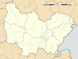
Taingy is situated in the central part of France. It is in the Auxerre arrondissement. This means it is part of a larger administrative area. The village is also in the Courson-les-Carrières canton. Cantons are smaller local divisions.
What is a Commune?
A commune is the smallest administrative division in France. Think of it like a town or a village. Each commune has its own local government. This government helps manage things like roads, schools, and local services. Taingy is one of many communes in France.
Exploring Taingy's Geography
Taingy's location gives it interesting geographical features. The village sits at different heights above sea level. This creates varied landscapes around the area.
How High is Taingy?
The lowest point in Taingy is 224 meters (about 735 feet) above sea level. The highest point reaches 386 meters (about 1,266 feet). This difference in elevation means you might find hills and valleys. These features add to the natural beauty of the commune.
How Big is the Area?
Taingy covers an area of 20.81 square kilometers. That's about 8 square miles. This size is typical for many French villages. It provides enough space for homes, farms, and natural areas. The land is often used for agriculture.
People and Population in Taingy
The number of people living in a commune is called its population. This number can change over time. It helps us understand the size of the community.
How Many People Live Here?
In 2006, the population of Taingy was 304 people. This makes it a small community. Small villages often have a close-knit feel. Everyone might know each other.
What Does Population Mean?
Population refers to the total number of residents. This count helps local governments plan for services. It also shows how a village is growing or changing. Taingy's population suggests a quiet, rural lifestyle.
Life in a French Commune
Life in a commune like Taingy often revolves around local traditions. People enjoy the peaceful environment. The community spirit is usually strong.
What is Daily Life Like?
Daily life in Taingy is likely calm and relaxed. Residents might enjoy the natural surroundings. They could participate in local events. Many people in rural France work in farming. Others might commute to nearby towns.
What About Local Government?
Every commune has a mayor. The mayor is the head of the local government. They work with a council to make decisions. These decisions affect the daily lives of the residents. They manage the budget and local projects.
See also
 In Spanish: Taingy para niños
 | James Van Der Zee |
 | Alma Thomas |
 | Ellis Wilson |
 | Margaret Taylor-Burroughs |


