Talahi Island, Georgia facts for kids
Quick facts for kids
Talahi Island, Georgia
|
|
|---|---|
| Country | United States |
| State | Georgia |
| County | Chatham |
| Area | |
| • Total | 1.48 sq mi (3.83 km2) |
| • Land | 1.29 sq mi (3.33 km2) |
| • Water | 0.19 sq mi (0.49 km2) |
| Elevation | 13 ft (4 m) |
| Population
(2020)
|
|
| • Total | 1,247 |
| • Density | 968.92/sq mi (374.12/km2) |
| Time zone | UTC-5 (Eastern (EST)) |
| • Summer (DST) | UTC-4 (EDT) |
| ZIP code |
31410
|
| Area code(s) | 912 |
| FIPS code | 13-75239 |
| GNIS feature ID | 2583406 |
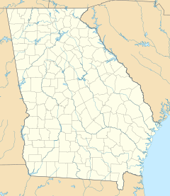
Talahi Island is a special place in Chatham County, Georgia, United States. It is a "barrier island," which means it's a long, narrow island that protects the mainland from ocean storms. It's also known as an "unincorporated community" and a "census-designated place" (CDP). This means it's a community that doesn't have its own city government, but the government still counts its population.
In 2020, about 1,247 people lived on Talahi Island. It's located between the big city of Savannah and the popular beach town of Tybee Island. Talahi Island is part of the larger Savannah area, which includes Savannah and its nearby towns.
Contents
Where is Talahi Island Located?
Talahi Island is in the eastern part of Chatham County. It's one of many islands found in the marshy areas between Savannah and the Atlantic Ocean. The island is surrounded by water: the Bull River is to its northeast, Turner Creek to its northwest, and Wilmington Island to its south.
A main road, U.S. Route 80, goes right through the island. If you drive west on this road, you'll reach Savannah in about 8 miles. If you go east, you'll get to Tybee Island and the Atlantic Ocean in about 9 miles.
The total area of Talahi Island is about 1.48 square miles (3.8 square kilometers). Most of this area, about 1.29 square miles (3.3 square kilometers), is land. The rest, about 0.19 square miles (0.5 square kilometers), is water.
Who Lives on Talahi Island?
The population of Talahi Island has stayed quite steady over the years. In 2010, there were 1,248 people living there. By 2020, the population was 1,247.
Talahi Island was first officially counted as a "census-designated place" in the 2010 U.S. Census. This is when the government started collecting detailed information about the people living there.
Understanding the People of Talahi Island
The table below shows the different groups of people who call Talahi Island home. The U.S. Census counts people by their race and also by whether they are of Hispanic or Latino origin. People of Hispanic or Latino origin can be of any race.
| Race / Ethnicity (NH = Non-Hispanic) | Pop 2010 | Pop 2020 | % 2010 | % 2020 |
|---|---|---|---|---|
| White alone (NH) | 1,161 | 1,133 | 93.03% | 90.86% |
| Black or African American alone (NH) | 29 | 20 | 2.32% | 1.60% |
| Native American or Alaska Native alone (NH) | 1 | 4 | 0.08% | 0.32% |
| Asian alone (NH) | 29 | 27 | 2.32% | 2.17% |
| Pacific Islander alone (NH) | 0 | 0 | 0.00% | 0.00% |
| Some Other Race alone (NH) | 1 | 6 | 0.08% | 0.48% |
| Mixed Race or Multi-Racial (NH) | 10 | 22 | 0.80% | 1.76% |
| Hispanic or Latino (any race) | 17 | 35 | 1.36% | 2.81% |
| Total | 1,248 | 1,247 | 100.00% | 100.00% |
See also
 In Spanish: Talahi Island para niños
 | James Van Der Zee |
 | Alma Thomas |
 | Ellis Wilson |
 | Margaret Taylor-Burroughs |


