Tassel Hill facts for kids
Quick facts for kids Tassel Hill |
|
|---|---|
| Highest point | |
| Elevation | 1,942 feet (592 m) |
| Prominence | 400 feet (120 m) |
| Listing | New York County High Points 38th |
| Geography | |
| Location | SW of Clayville, New York, U.S. |
| Topo map | USGS Cassville |
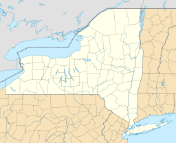
Tassel Hill is a mountain located in the Central New York Region of New York State. It is found southwest of a small town called Clayville, New York. Tassel Hill is an important landmark because it is the highest point in Oneida County. It is also ranked as the 38th highest point among all 62 counties in New York State.
Contents
Exploring Tassel Hill
Tassel Hill is a well-known natural feature in its area. It stands out in the landscape of Oneida County. People who enjoy exploring nature often look for places like Tassel Hill.
Where is Tassel Hill Located?
This mountain is situated in the central part of New York State. You can find it southwest of Clayville, which is a community in Oneida County. Its exact location helps people find it on maps and plan visits.
How High is Tassel Hill?
Tassel Hill reaches an elevation of 1,942 feet (about 592 meters) above sea level. This makes it the tallest natural point in Oneida County. Its height is measured by groups like the USGS, which creates detailed maps of the land.
What is a County High Point?
A "county high point" is simply the highest natural elevation within a specific county. Tassel Hill holds this title for Oneida County. New York State has 62 counties, and each one has a highest point. Tassel Hill is listed as the 38th highest among all these county high points across the state. This means there are 37 other counties with higher points than Tassel Hill, and 24 with lower ones.
 | Janet Taylor Pickett |
 | Synthia Saint James |
 | Howardena Pindell |
 | Faith Ringgold |


