Tate City, Georgia facts for kids
Quick facts for kids
Tate City, Georgia
|
|
|---|---|
| Country | |
| State | Georgia |
| County | Towns |
| Area | |
| • Total | 1.03 sq mi (2.7 km2) |
| • Land | 1.051 sq mi (2.72 km2) |
| • Water | 0.021 sq mi (0.05 km2) |
| Elevation | 2,497 ft (761 m) |
| Time zone | UTC-5 (Eastern (EST)) |
| • Summer (DST) | UTC-4 (EDT) |
| GNIS feature ID | 2587049 |
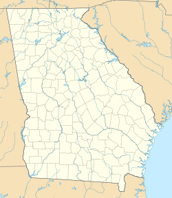
Tate City is a small, unincorporated community and a census-designated place (CDP) located in Towns County, Georgia, United States. This means it's a recognized area for collecting census data, but it doesn't have its own local government like a city or town.
Tate City began as a place for mining and logging. It was named after a local businessperson, Mr. Tate, who was involved in the lumber industry. The community is nestled in a beautiful valley along the upper Tallulah River. It sits just south of the border between Georgia and North Carolina.
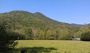
The area around Tate City is surrounded by tall mountains. These include peaks from the Blue Ridge and Nantahala Mountains. Some of these mountains are Hightower Bald (4,568 feet), Dicks Knob (4,640 feet), and Standing Indian Mountain (5,499 feet).
Who Lives in Tate City?
Tate City was first counted as a CDP in the 2010 United States Census. The population has changed over the years.
| Race / Ethnicity (NH = Not Hispanic) | Pop 2010 | Pop 2020 | % 2010 | % 2020 |
|---|---|---|---|---|
| White alone (NH) | 16 | 24 | 100.00% | 88.89% |
| Black or African American alone (NH) | 0 | 0 | 0.00% | 0.00% |
| Native American or Alaska Native alone (NH) | 0 | 0 | 0.00% | 0.00% |
| Asian alone (NH) | 0 | 0 | 0.00% | 0.00% |
| Pacific Islander alone (NH) | 0 | 0 | 0.00% | 0.00% |
| Some Other Race alone (NH) | 0 | 0 | 0.00% | 0.00% |
| Mixed Race or Multi-Racial (NH) | 0 | 1 | 0.00% | 3.70% |
| Hispanic or Latino (any race) | 0 | 2 | 0.00% | 7.41% |
| Total | 16 | 27 | 100.00% | 100.00% |
The table above shows the different groups of people who live in Tate City. In 2010, there were 16 people, all identified as White (not Hispanic). By 2020, the population had grown to 27 people. Most residents were still White (not Hispanic), but there were also some people who identified as Mixed Race and some who were Hispanic or Latino.
See also
 In Spanish: Tate City para niños
 | Chris Smalls |
 | Fred Hampton |
 | Ralph Abernathy |


