Standing Indian Mountain facts for kids
Quick facts for kids Standing Indian Mountain |
|
|---|---|

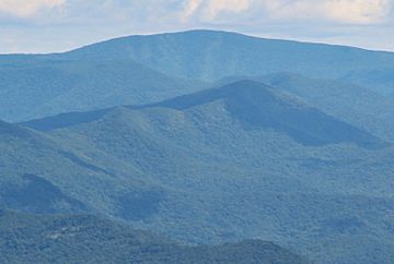
Standing Indian Mountain viewed from Brasstown Bald
|
|
| Highest point | |
| Elevation | 5,499 ft (1,676 m) |
| Prominence | 2,819 ft (859 m) |
| Geography | |
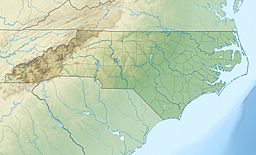
| Location | Clay County and Macon County, North Carolina, United States |
| Parent range | Appalachian Mountains |
| Topo map | USGS Rainbow Springs |
| Climbing | |
| Easiest route | Hike |
Standing Indian Mountain is a tall mountain in North Carolina. It stands 5,499 feet high. This mountain is part of the Southern Nantahala Wilderness. It is also inside the Nantahala National Forest.
The famous Appalachian Trail goes right over Standing Indian Mountain. It is also the highest point along the Nantahala River.
What's in a Name?
The Cherokee people have a special name for Standing Indian Mountain. They call it Yunwitsule-nunyi. This means "where the man stood."
There is an old Cherokee story about how the mountain got its name. Long ago, a brave Cherokee warrior was sent to the mountaintop. His job was to watch for a scary winged monster. This monster would fly down and take children.
The warrior found the monster's home on the mountain. The Cherokee people then prayed to the Great Spirit for help. The Great Spirit answered their prayers. It destroyed the monster and its home with thunder and lightning.
The lightning scared the warrior. He tried to run away from his post. Because he left his duty, the warrior was turned into stone. He became a stone statue for being afraid.
Where is Standing Indian Mountain?
Standing Indian Mountain is located in the Southern Nantahala Wilderness. It is a very tall mountain, reaching 5,499 feet (about 1,676 meters) into the sky.
Another mountain, Albert Mountain, is about 3.5 miles (5.6 km) north. The city of Dillard, Georgia is about 10 miles (16 km) southeast. The mountain's top is also about 3 miles (4.8 km) north of the Georgia border.
Hiking to the Top
Many people enjoy hiking to the top of Standing Indian Mountain. The famous Appalachian Trail goes right over its summit.
There are a few ways to reach the top:
- From the Deep Gap parking area, it is a 2.5-mile (4 km) hike. You follow the Appalachian Trail all the way up.
- From the Standing Indian Campground, it is a bit longer. You hike 4.1 miles (6.6 km) on the Lower Ridge Trail. Then, you hike 0.1 miles (0.16 km) on the Appalachian Trail. This makes a total hike of 4.2 miles (6.8 km).
 | Misty Copeland |
 | Raven Wilkinson |
 | Debra Austin |
 | Aesha Ash |


