Hightower Bald facts for kids
Quick facts for kids Hightower Bald |
|
|---|---|

Hightower Bald
|
|
| Highest point | |
| Elevation | 4,568 ft (1,392 m) |
| Prominence | 848 ft (258 m) |
| Geography | |
| Parent range | Blue Ridge Mountains |
| Topo map | USGS Hightower Bald |
| Climbing | |
| Easiest route | Hike |
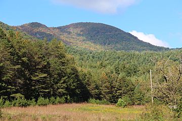
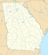
Hightower Bald is a tall mountain in Georgia, USA. It stands 4,568 feet (1,392 m) high, making it the fourth-tallest peak in the state! You can find it in Towns County, Georgia, right on the border with North Carolina. This mountain is part of a special protected area called the Southern Nantahala Wilderness, which is inside the Chattahoochee National Forest.
Contents
Exploring Hightower Bald's Location
Hightower Bald sits on a ridge that runs from east to west. It's deep within the Southern Nantahala Wilderness, which is part of the Chattahoochee National Forest in Towns County, Georgia. The mountain is about 8 miles (13 km) east of a town called Hiawassee. It's also about 4 miles (6.4 km) west of Tate City.
Nearby, you'll find other interesting spots like Rich Knob and Shooting Creek Bald. There's also a place called Loggy Branch Cove and Bly Gap. If you look at the south side of Hightower Bald, you'll see some steep cliffs.
The Mystery of the Border Line
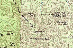
On the northern slopes of Hightower Bald, there are two special markers: Montgomery's Corner and the 30 Mile Post. Usually, the border between North Carolina and Georgia runs east to west. But between these two markers, the border goes north to south for about 2,000 feet (610 m)!
This unusual border happened because of some old land surveys. In the early 1800s, surveyors tried to draw Georgia's northern border. A mathematician named James Camak made a mistake in 1818. He thought the border was further south than it actually was.
The next year, in 1819, Camak did another survey. When his team reached Hightower Bald's northern slopes, they realized their new line was 661 yards (604 m) north of their old mark! Instead of starting over, Camak just connected the two lines. The southern mark was named Montgomery's Corner, after one of the surveyors. This old mistake even played a part in a water dispute between Georgia and Tennessee later on.
Plants and Animals of Hightower Bald
Hightower Bald is home to many interesting plants and animals. The very top of the mountain has a special dwarf forest. Here, you'll find small red oak trees. Underneath them grow beaked hazel and hawthorn trees.
Unique Plants on the Cliffs
The cliffs on Hightower Bald are a great place for unique plants. You might spot Hypericum (also known as Blue Ridge St. John's wort). There's also selaginella rupestris (rock spikemoss) and viburnum alnifolium (wild hydrangea).
Forest Life in Loggy Branch Cove
On the northern side of the mountain, in Loggy Branch Cove, the forest is different. It's called a broadleaf deciduous cove forest. Here, you can find tall trees like Acer saccharum (Sugar Maple), cladrastis kentukea (yellowwood), Liriodendron tulipifera (tulip tree), and birch trees.
Animals Living on the Mountain
Besides the plants, animals also call Hightower Bald home. One small creature you might find here is the Red-backed vole. These tiny rodents are part of the mountain's ecosystem.
Hiking Adventures on Hightower Bald
If you love hiking, Hightower Bald offers a challenge! There are no official trails that go right over the mountain's top. However, experienced hikers can reach the summit by hiking off-trail. You can start your adventure by hiking west from the famous Appalachian Trail at either Rich Knob or Bly Gap. Remember to be prepared for an off-trail journey!
 | Lonnie Johnson |
 | Granville Woods |
 | Lewis Howard Latimer |
 | James West |


