Tennyson Trail facts for kids
Quick facts for kids The Tennyson Trail |
|
|---|---|
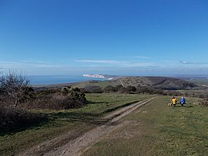
Fine views west along the trail from the top of Mottistone Down. Tennyson Down can be seen in the distance (white chalk cliffs).
|
|
| Length | 14 mi (23 km) |
| Location | Isle of Wight |
| Trailheads | Carisbrooke 50°41′27″N 1°19′09″W / 50.6907°N 1.3193°W The Needles 50°40′00″N 1°33′57″W / 50.6666°N 1.5658°W |
| Use | Hiking |
| Difficulty | Moderate |
| Season | All year |
| Sights | The Needles Battery |
The Tennyson Trail is a fantastic 14-mile (about 22.5 km) walking path on the beautiful Isle of Wight. It stretches all the way from Carisbrooke to The Needles, which are famous chalk stacks in the sea.
This trail is named after a famous poet, Alfred Lord Tennyson, who used to live on the Isle of Wight. As you walk, you'll pass through many interesting places like Brighstone Forest, Mottistone Down, Freshwater Bay, and Tennyson Down.
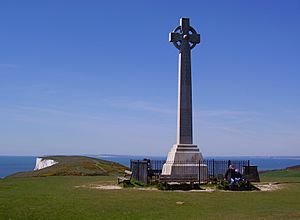
Along the way, you'll see some cool sights. These include the Tennyson Monument on Tennyson Down, Farringford House (where Tennyson lived), and The Needles Batteries, which are old forts overlooking the famous Needles rocks.
For a long time, the Tennyson Trail was open to all kinds of vehicles, even cars and motorbikes. But by the early 2000s, too many off-road vehicles were using the path. This started to damage the tracks, old historical sites, and even the homes of wildlife. Because of this, the Isle of Wight council decided in 2006 to ban all motor vehicles from the trail. Now, it's a peaceful path mainly for walkers, cyclists, and horse riders.
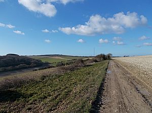
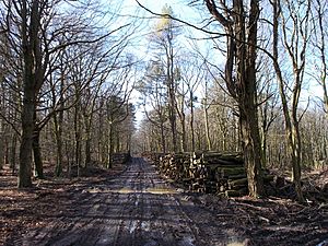
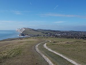
You can start the Tennyson Trail from any point, and walk in either direction. However, this guide describes the journey from Carisbrooke to Alum Bay.
Contents
Starting Your Adventure: Carisbrooke to Brighstone
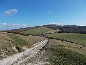
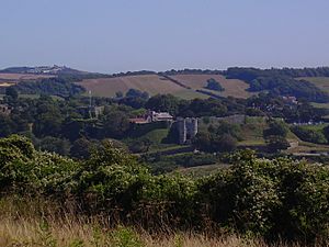
Your journey begins in Carisbrooke, a village close to Newport. Look for the sign for the Tennyson Trail on Nodgham Lane. From there, the path goes up a steep hill. This old road has banks on both sides. As you climb, you'll get great views of Carisbrooke Castle to your left, and then the beautiful Bowcombe Valley.
The path continues, passing through open fields. You'll see a television mast in the distance. The trail then starts to go downhill before you cross a gate. After this, you'll walk towards Brighstone Forest. You'll pass under an electrical cable and walk next to a narrow beech tree plantation. The trail then goes uphill again through open fields before it levels out. Soon, you'll find yourself walking through the trees of Brighstone Forest.
Through the Woods: Brighstone to Brook
As you enter Brighstone Forest, you'll see more signs guiding you along the Tennyson Trail. The path here starts to go downhill. You'll reach a spot where five paths meet. Keep going straight, and you'll see a signpost. Follow the sign for the Tennyson Trail to the right, which leads you towards Brighstone Down.
The trail continues west along this path, offering lovely sea views to your left. It then gently slopes downhill to a picnic area. From there, you'll turn right, then left, passing through the National Trust Jubilee Car Park. You'll walk past an information board and the entrance to Brighstone Forest. The trail then follows an old road up to the top of the down.
After passing through a gate, you'll walk on level ground. Look out for ancient burial mounds on your right! The path then goes downhill to another gate, leading into a field. The Tennyson Trail is clearly marked here. You'll then walk down through the field until you reach the B3399 road. This road leads to Freshwater and Yarmouth to the right, and Brook to the left.
Coastal Views: Brook to Freshwater
When you reach the road, turn right towards Freshwater. The Tennyson Trail quickly starts again on your left, next to a bus stop and car park. This part of the trail is on Compton Down. The path immediately climbs steeply, passing an old chalk pit on your right. It then turns right to avoid some overhead electric cables.
The trail continues straight ahead, slowly gaining height as you walk towards Afton Down. You'll then walk through the golf course on Afton Down. After this, the path starts to go downhill, leading you right to Freshwater Bay.
The Final Stretch: Freshwater to Alum Bay
From Freshwater Bay, the Tennyson Trail joins the Isle of Wight Coastal Path. You'll find it next to some public toilets on the lane that goes to Fort Redoubt. This lane then turns sharply left, and you'll pass through two gates to get onto Tennyson Down.
From here, the trail follows the coastline, climbing steadily up to the Tennyson Monument. Once you reach the monument, the ground starts to go downhill. At the bottom of Tennyson Down, you'll find a gate leading onto West High Down. This section has a steady climb until you see a radio aerial. After passing another gate near the aerial, the trail turns right onto a paved road.
From this road, you can see The Needles Battery to your left. The road passes a row of cottages and then turns sharply left. Here, you'll find a gate with a path going downhill, and another gate that leads you back onto the road. This road continues downwards, bringing you to Alum Bay. This marks the end of the amazing Tennyson Trail!
 | Ernest Everett Just |
 | Mary Jackson |
 | Emmett Chappelle |
 | Marie Maynard Daly |


