Terrapin Mountain facts for kids
Quick facts for kids Terrapin Mountain |
|
|---|---|
 |
|
| Highest point | |
| Elevation | 2,954 m (9,692 ft) |
| Prominence | 235 m (771 ft) |
| Geography | |
| Location | Alberta British Columbia |
| Topo map | NTS 82J/13 |
| Climbing | |
| First ascent | 1915 H.O. Frind, L. Jeffers, Conrad Kain |
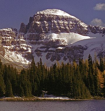
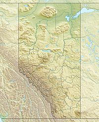
Terrapin Mountain is a cool peak found right on the edge between two Canadian provinces: Alberta and British Columbia. It sits on the Continental Divide, which is like a giant natural line that separates which way rainwater flows. On one side, water flows towards the Pacific Ocean, and on the other, it flows towards the Atlantic or Arctic Oceans. The mountain got its name in 1918. A long, high ridge of land stretches north from Terrapin Mountain and ends at a spot called Naiset Point.
Mountain Climate: What's the Weather Like?
Terrapin Mountain has a subarctic climate. This type of weather is figured out using something called the Köppen climate classification system. It's a way scientists group climates around the world based on temperature and how much rain or snow falls.
In a subarctic climate, winters are super cold and snowy. Summers are usually mild, not too hot. On Terrapin Mountain, temperatures can drop below -20 °C (that's -4 °F!). With the wind blowing, it can feel even colder, sometimes below -30 °C (-22 °F) because of something called wind chill.
 | Madam C. J. Walker |
 | Janet Emerson Bashen |
 | Annie Turnbo Malone |
 | Maggie L. Walker |


