Thames Ditton Island facts for kids
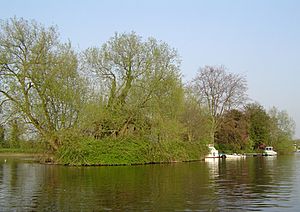
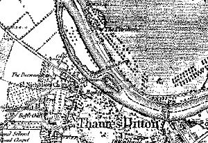
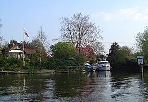
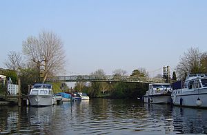
Thames Ditton Island is one of three small islands, also called aits, located in the River Thames. These islands are found near the old streets of Thames Ditton village in Surrey. Thames Ditton Island is the largest, stretching about 350 yards long. It has 48 houses, each with its own garden and a place to moor boats. The other two islands are Boyle Farm Island, which has one house, and Swan Island, the smallest, located between the other two.
Contents
History of the Islands
About 300 years before the first Teddington Lock was built in 1810, Henry VIII lived at Hampton Court Palace. Back then, the River Thames didn't have locks to control its water level. This meant the river could be very wide and twisty, especially when the tide was low or after heavy rain.
People traveling from London to Hampton Court, including kings like George II, often preferred to be rowed up the river instead of using carriages on muddy roads. To make it easier for boats to reach Hampton Court and to help with flooding in the village, Cardinal Wolsey or King Henry VIII had the main river channel dug straighter. This also got rid of a shallow crossing, or ford, that used to be near Hampton Court.
River Crossings and Bridges
Before Hampton Court Bridge was built, a ferry helped people cross the river to Hampton Court. This ferry was important for people and carriages coming from the western part of Surrey. The lane to the ferry ran along Thames Ditton High Street to a public slipway where the river was wide. At low tide, people could even walk across a ford. When the tide was in, ferrymen would charge a small fee.
The first wooden bridge over the river at Hampton Court opened in 1753. It was a toll bridge, meaning you had to pay to cross. A ferry still operated near the islands until at least 1911, and it charged less than the bridge. The first bridge was replaced by a stronger wooden one in 1778. Later, in 1865, a steel and brick bridge was built, and the current concrete bridge was put in place in 1933.
The first locks on the River Thames started to appear in the late 1700s. The Molesey Lock, for example, was built in 1815. These locks helped control the river's water level, making it more like it is today.
Island Ownership Changes
In the 1800s, Boyle Farm was owned by Edward Sugden, 1st Baron St Leonards, who was a very important legal expert and a Lord Chancellor. For a long time, Thames Ditton Island was part of Middlesex, and then Greater London from 1965. However, in 1930, the people living on the island asked to become part of Surrey. This change finally happened on April 1, 1970, when the island moved from the London Borough of Richmond upon Thames to Esher Urban District in Surrey.
How the Island Was Used in the Past
For many centuries, Thames Ditton Island was part of a larger estate called the Manor of Imworth. In 1608, the island was known as Colly's Eite (another name for an ait or small island) and was described as "2 acres of pasture." On the Surrey bank, across from the island, there was a slipway and a wharf near the Swan Inn. This area was a busy dock for moving goods and people along the river. Large sailing barges from the Port of London would stop here to load or unload.
At first, the island was mostly a muddy area. However, people from Kingston would moor their small boats, called skiffs, there to enjoy picnics by the river. In the early 1900s, it became popular to build small holiday homes, or chalets, along the river. Many of these were built on the island. Life there was like indoor camping because there were no modern facilities. People had to bring water and paraffin (for lamps) in cans, and only the nicer sheds had a proper toilet.
Over time, more and more people were drawn to the beautiful riverside location. By 1930, the entire edge of the island was covered with wooden bungalows, and owners kept their boats at the end of their gardens. The building of a suspension bridge in 1939 by David Rowell & Co. made the island much more accessible. This bridge allowed people to walk onto the island and brought in water, electricity, and gas. It also made it possible to connect homes to the town's sewage system, allowing for modern toilets.
Initially, people leased their homes from the island's owner, who was the owner of the Olde Swan pub. But by 1963, all the houses were owned outright by the residents. A company was then formed to take care of the bridge and the nearby gardens, and to provide maintenance services for the island.
Boyle Farm Island
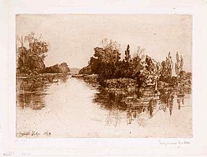
Boyle Farm Island is the second largest of the three islands. It is mostly natural, with just one family house and some light reinforcement along its banks. This island is directly across from the historic Boyle Farm mansion, which is now a Home of Compassion. Unlike Thames Ditton Island, Boyle Farm Island has always been part of Surrey.
Swan Island
Swan Island is the smallest of the three islands. It once had a small hut for the ferryman, which has recently been rebuilt by its current owner. A local historian, Philip J. Burchett, thought that the original ferryman must have had a tough life, taking people across the river and to and from the island for a small fee, day and night. After a flood washed away part of the main island, Swan Island became connected to it by a bridge made of plants and soil when the river flows normally.
How the Island Is Used Today
Today, each homeowner on Thames Ditton Island is part of a company that manages the island. Their main jobs include buying water for the island and regularly repainting the bridge. The 47 properties on the island are all private homes, and most have their own moorings for boats.
Almost all the houses are built on brick piles, which helps protect them from flood damage. However, during the floods in 2007, the river rose and covered the island with several feet of water. In early 2014, the island flooded again to a similar depth. The river level at Thames Ditton during that time was the highest recorded since measurements began in 2003.
 | Laphonza Butler |
 | Daisy Bates |
 | Elizabeth Piper Ensley |


