Ticaboo, Utah facts for kids
Ticaboo is a small, quiet community in a very remote part of Utah, United States. It's located in Garfield County, far to the southeast. People often call it an "unincorporated community," which means it's a place with a group of homes and businesses, but it doesn't have its own local government like a city or town.
Quick facts for kids
Ticaboo, Utah
|
|
|---|---|

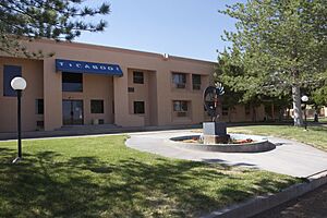
Image of Ticaboo, with Mt. Ellsworth in the background, May 2008
|
|
| Country | United States |
| State | Utah |
| County | Garfield |
| Founded | 1977 |
| Founded by | A. Roy May |
| Government
- Utilities are managed by Ticaboo Utility Improvement District
|
|
| • Type | Local Improvement District |
| Elevation | 4,265 ft (1,300 m) |
| Time zone | UTC-7 (Mountain (MST)) |
| • Summer (DST) | UTC-6 (MDT) |
| ZIP codes |
84533
|
| Area code(s) | 435 |
| GNIS feature ID | 1434980 |
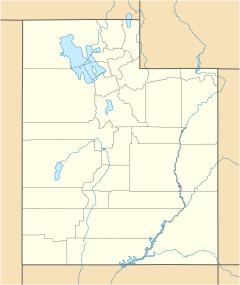
Ticaboo (/ˈtɪkəbuː/ tik-Ə-boo) is an unincorporated community in far southeastern Garfield County, Utah, United States.
Contents
What is Ticaboo Like?
Ticaboo is found along State Route 276. This road is more than 90 miles (about 145 kilometers) east of Panguitch, which is the main town in Garfield County. Ticaboo sits at an elevation of about 4,265 feet (1,300 meters) above sea level. It has its own post office with the ZIP code 84533.
Where Did the Name Ticaboo Come From?
The name Ticaboo comes from Ticaboo Creek. A person named Cass Hite named the creek in the 1880s. The name comes from a Paiute word that means "friendly."
The History of Ticaboo
The community of Ticaboo was planned and built in the late 1970s. It was created for two main reasons:
- To provide homes for people working in the uranium mining industry. Uranium mining was very active in this part of Garfield County at the time.
- To welcome tourists visiting the beautiful Lake Powell area nearby.
The Ticaboo Lodge was built to attract guests. It also helped to grow tourism in the northern Lake Powell area, away from the town of Bullfrog.
Early Inhabitants of the Area
The first people to live in the Ticaboo area were the Kayenta Anasazi. In October 1981, experts from the Utah State History Division studied an old settlement. This settlement, known as the Ticaboo Town Ruins, is located just west of the modern town of Ticaboo.
Who Helped Develop Ticaboo?
Latt Boren is currently in charge of developing Ticaboo. He works with the Utah School and Trust Lands Administration (SITLA). Before him, mining companies also helped develop the area. They owned mines in the Henry Mountain Complex or the Shootaring Mill. Plateau Resources Limited was a key developer, starting in 1977. This company built important things like the electricity, water, and wastewater systems that are still used today.
Trail of the Ancients
Ticaboo is located on Utah State Route 276. This road is part of a special route called the Trail of the Ancients National Scenic Byway. A "Scenic Byway" is a road chosen for its natural beauty or historical importance.
 | Percy Lavon Julian |
 | Katherine Johnson |
 | George Washington Carver |
 | Annie Easley |


