Tijarafe facts for kids
Quick facts for kids
Tijarafe
|
|||
|---|---|---|---|
|
|||
 |
|||
| Country | Spain | ||
| Autonomous community | Canary Islands | ||
| Province | Santa Cruz de Tenerife | ||
| Island | La Palma | ||
| Area | |||
| • Total | 53.76 km2 (20.76 sq mi) | ||
| Population
(2018)
|
|||
| • Total | 2,564 | ||
| • Density | 47.693/km2 (123.53/sq mi) | ||
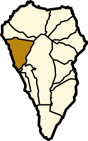
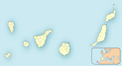
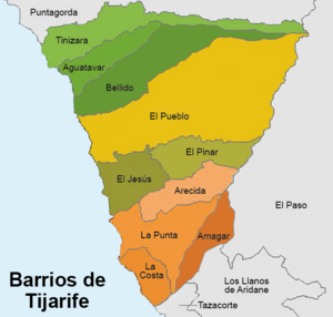
Tijarafe is a town and a special area (called a municipality) on the island of La Palma. This island is part of the Canary Islands in Spain. You can find Tijarafe in the northwest part of La Palma.
In 2013, about 2,776 people lived there. The whole area of Tijarafe is about 53.76 square kilometers. It is located about 7 kilometers northwest of Los Llanos de Aridane. It's also about 19 kilometers west of Santa Cruz de La Palma, which is the island's capital city.
Geography of Tijarafe
The eastern edge of Tijarafe is formed by the big crater rim of the Caldera de Taburiente. This crater is like a giant bowl in the mountains. Water flows out from it through a valley called the Barranco de las Angustias.
History of Tijarafe
Long ago, before the Spanish arrived, the Guanches people lived on La Palma. They had twelve main areas where they settled. One of these areas was also called Tijarafe. This old area covered what are now the municipalities of Tijarafe and Puntagorda.
Population Changes Over Time
The number of people living in Tijarafe has changed over the years. Here's a look at how the population has grown or shrunk:
| Year | Population |
|---|---|
| 1991 | 2,195 |
| 1996 | 2,658 |
| 2001 | 2,730 |
| 2002 | 2,765 |
| 2003 | 2,687 |
| 2004 | 2,666 |
| 2008 | 2,757 |
| 2009 | 2,768 |
| 2013 | 2,776 |
See also
 In Spanish: Tijarafe para niños
 | Emma Amos |
 | Edward Mitchell Bannister |
 | Larry D. Alexander |
 | Ernie Barnes |


