Timberville, Virginia facts for kids
Quick facts for kids
Timberville, Virginia
|
|
|---|---|

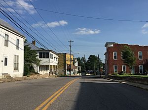
Main Street in Timberville
|
|

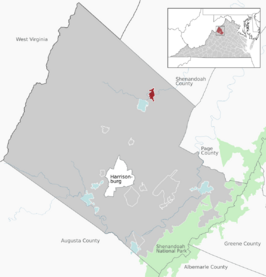
Location of Timberville within Rockingham County
|
|
| Country | United States |
| State | Virginia |
| County | Rockingham |
| Incorporated | 1884 |
| Government | |
| • Type | Council-manager government |
| Area | |
| • Total | 1.35 sq mi (3.51 km2) |
| • Land | 1.34 sq mi (3.46 km2) |
| • Water | 0.02 sq mi (0.05 km2) |
| Elevation | 1,020 ft (310 m) |
| Population
(2010)
|
|
| • Total | 2,522 |
| • Estimate
(2019)
|
2,691 |
| • Density | 2,014.22/sq mi (777.45/km2) |
| Time zone | UTC−5 (Eastern (EST)) |
| • Summer (DST) | UTC−4 (EDT) |
| ZIP code |
22853
|
| Area code(s) | 540 |
| FIPS code | 51-78736 |
| GNIS feature ID | 1500227 |
Timberville is a small town located in Rockingham County, Virginia, United States. It's a friendly place that has grown quite a bit over the years. In 2010, about 2,522 people lived there. This was a big jump from the 1,739 people counted in 2000.
Timberville is part of the larger Harrisonburg area. This means it's connected to a bigger group of towns and cities around Harrisonburg.
Contents
Discovering Timberville's Past
Before European settlers arrived, the land where Timberville now stands was home to Indigenous people for thousands of years. They lived on and cared for this land.
The first white settlers in Timberville were mostly from a group called the Pennsylvania Dutch. These families moved to the beautiful Shenandoah Valley. They helped build the early community of Timberville.
Exploring Timberville's Location
Timberville is located at specific coordinates: 38.634273 degrees North and -78.776422 degrees West. These numbers help pinpoint its exact spot on a map.
The town covers a total area of about 0.9 square miles (2.3 square kilometers). All of this area is land, meaning there are no large lakes or rivers within the town limits.
Getting Around Timberville
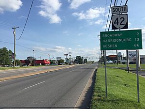
The main roads that help people get to and from Timberville are Virginia State Route 42 and Virginia State Route 211.
- Virginia State Route 42 runs north and south. To the south, it connects Timberville to Virginia State Route 259 in the town of Broadway. If you head north on SR 42, you'll mostly travel through quiet, rural areas in southwestern Shenandoah County.
- Virginia State Route 211 goes east from Timberville. This road links up with Interstate 81 and U.S. Route 211 in the town of New Market. These connections make it easier to travel to other parts of Virginia.
Understanding Timberville's Population
| Historical population | |||
|---|---|---|---|
| Census | Pop. | %± | |
| 1880 | 112 | — | |
| 1900 | 173 | — | |
| 1910 | 240 | 38.7% | |
| 1920 | 277 | 15.4% | |
| 1930 | 302 | 9.0% | |
| 1940 | 253 | −16.2% | |
| 1950 | 271 | 7.1% | |
| 1960 | 412 | 52.0% | |
| 1970 | 959 | 132.8% | |
| 1980 | 1,510 | 57.5% | |
| 1990 | 1,596 | 5.7% | |
| 2000 | 1,739 | 9.0% | |
| 2010 | 2,522 | 45.0% | |
| 2019 (est.) | 2,691 | 6.7% | |
| U.S. Decennial Census | |||
The number of people living in Timberville has changed a lot over the years. In 2000, there were 1,739 people living in 735 households. By 2010, the population had grown to 2,522. This shows that more people are choosing to live in Timberville.
In 2000, most residents were White. A small percentage were from other racial backgrounds. About 4.31% of the population identified as Hispanic or Latino. Many residents have German heritage, and others have English or Irish roots.
The average household in Timberville had about 2.29 people. The average family had about 2.89 people. In 2000, about 22% of the population was under 18 years old. About 21.3% of residents were 65 or older. The average age in Timberville was 40 years old.
The median income for a household in 2000 was $33,750. This means half of the households earned more than this amount, and half earned less. For families, the median income was $41,417.
See also
 In Spanish: Timberville (Virginia) para niños


