
Tocantins River facts for kids
Quick facts for kids Tocantins River |
|
|---|---|

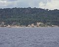
Tocantins River and Fernando Henrique Cardoso bridge
|
|

Map of the Araguaia/Tocantins Watershed
|
|
| Other name(s) | Pyti (Parkatêjê) |
| Country | Brazil |
| Physical characteristics | |
| River mouth | Marajó Bay 1°45′S 49°10′W / 1.750°S 49.167°W |
| Length | 2,640 km (1,640 mi) |
| Basin features | |
| River system | Tocantins basin |
| Basin size | 764,183 km2 (295,053 sq mi) |
| Tributaries |
|
The Tocantins River is a very important river in Brazil. It is like the main water highway of the country. In the Tupi language, its name means "toucan's beak." This river flows from south to north for about 2,450 kilometers (1,522 miles).
Even though it's close to the Amazon River, the Tocantins is not a part of it. Its waters flow directly into the Atlantic Ocean, right next to the Amazon's mouth. The river passes through four Brazilian states: Goiás, Tocantins, Maranhão, and Pará. One of these states, Tocantins, was even named after the river when it was created in 1988. The Tocantins is known as one of the largest clearwater rivers in South America. This means its water is very clear, not muddy.
Contents
Where the Tocantins River Starts and Flows
The Tocantins River begins in a mountain area called the Pireneus, which is west of Brazil's capital city. One of its main branches, the Araguaia River, starts even further south in the Serra dos Caiapós mountains. The Araguaia River flows for 1,670 kilometers (1,038 miles) before it joins the Tocantins. It's almost as big as the Tocantins itself!
The Araguaia has many smaller rivers that flow into it. These smaller rivers are great for canoe trips. As the river moves towards lower lands, it often forms beautiful waterfalls and fast-moving rapids. It also carves its way through rocky canyons. About 160 kilometers (100 miles) before it meets the Tocantins, the Araguaia cuts through a rocky barrier, creating powerful waterfalls.

Other rivers, like the Maranhão and Paranatinga, also add a lot of water to the Tocantins. These rivers come from the high lands around them. Sometimes, between the Paranatinga and where the Araguaia joins, the Tocantins River can be blocked by rocky walls that cross it.
Amazing Animals of the Tocantins Basin
The area around the Tocantins River, including the Araguaia River, is home to many large water animals. You can find amazing creatures like the Amazonian manatee, which is a gentle giant. There are also river dolphins, such as the Araguaian river dolphin and the tucuxi.
Big reptiles also live here. These include the black caiman, the spectacled caiman, and the yellow-spotted river turtle.
Fish Species and Their Journeys
The Tocantins River Basin has many different kinds of fish. Over 350 types of fish have been found here! More than 175 of these fish types are found nowhere else in the world. The most common fish families are Characidae (like tetras), Loricariidae (like pleco catfish), and Rivulidae (South American killifish).
Many fish species travel along the Tocantins River to lay their eggs. This is called migration. However, large dams built on the river have made it harder for these fish to migrate. After the huge Tucuruí Dam was built, the river's flow changed a lot. This has hurt some fish species, and there are fewer types of fish in some parts of the river now.
Unique Cave Fish
In the upper part of the Tocantins basin, there's a special area with caves called the São Domingos karst. These caves are home to many unique cavefish species. In fact, more cavefish species live here than anywhere else in North or South America! Some of these special fish include Ancistrus cryptophthalmus, several Ituglanis species, and Aspidoras mephisto. One fish, Eigenmannia vicentespelaea, is the only known cave-adapted knifefish.
The lower part of the Tocantins River also acts like a natural wall. It separates two different forest areas, preventing plants and animals from easily moving between them.
Dams on the Tocantins River
Further down the river, in the state of Pará, there used to be many waterfalls and rapids. But in the 1980s, these areas were covered by a huge artificial lake. This lake was created by the Tucuruí Dam, which is one of the biggest dams in the world.
In 2010, the second part of the Tucuruí project was finished. This added a system of locks called Eclusas do Tucuruí. These locks help boats travel along a long part of the river, making it easier to navigate.
In total, there are five dams on the Tocantins River. The biggest ones are the Tucuruí Dam and the Serra da Mesa Dam.
How the River Shaped the Land
The Tocantins River and its Araguaia branch flow through wide, flat valleys made of sand and clay. These valleys are surrounded by steep cliffs. These cliffs are the edges of large sandstone plateaus, which are like flat-topped mountains. The rivers have slowly cut deep beds through these plateaus over time.
Near where the Tocantins River meets the ocean, the big plateau disappears. Instead, there's a large, forest-covered plain that is sometimes underwater. This plain stretches far to the northeast and west. The Pará River, which many people think is a mouth of the Amazon, is actually just the lower part of the Tocantins River. If any water from the Amazon flows into the Pará River, it's only through small, winding natural canals.
Images for kids
-
The banks of the Tocantins are rocky in some places

See also
In Spanish: Río Tocantins para niños
