Tomahawk Lagoon facts for kids
Quick facts for kids Tomahawk Lagoon |
|
|---|---|

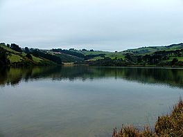
The bottom lagoon, seen from Ocean Grove
|
|
| Location | Dunedin, New Zealand |
| Coordinates | 45°54′07″S 170°32′43″E / 45.901955°S 170.545389°E |
| Catchment area | 466 ha (4.66 km2) |
| Surface area | 30 ha (0.30 km2) |
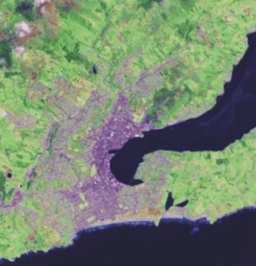
Tomahawk Lagoon is a special water area in Dunedin, New Zealand. It's called a "twin-lobed lagoon" because it has two main parts, like two connected lakes. You can find it at the western end of the Otago Peninsula.
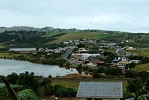
The lagoon is very close to the edge of Dunedin city. It's near a suburb called Ocean Grove. This area used to be known as Tomahawk until the 1930s.
Contents
What's in a Name?
The name "Tomahawk" for this lagoon is quite old. It was first written down in 1852. It's probably not named after the weapon called a tomahawk.
Instead, it's thought to be an English version of Māori words. These words are likely toma haka. Toma means a place where bones are kept, or a special shrine for bones. Haka can mean the famous Māori dance of challenge.
So, toma haka might mean "dance by a gravesite". However, some people think haka here might be a different Māori word. In the South Island Māori dialect, hanga means "to build" or "to create". Even with these ideas, no old burial sites or human bones have been found here.
Exploring the Lagoon's Geography
Tomahawk Lagoon is connected to the Pacific Ocean by a short stream. Even though it's called a lagoon, it's more like a shallow lake. The sea never completely covers it. Most of the lagoon is less than 1.5 meters deep.
The Two Parts of the Lagoon
Tomahawk Lagoon has two main sections, often called lobes.
- The Top Lagoon is the inner part. It is a special place set aside to protect wildlife.
- The Bottom Lagoon is the outer part and is larger.
The Bottom Lagoon is about 900 meters long. It is also about 300 meters wide at its widest point. This part of the lagoon covers an area of nearly 20 hectares.
The Top Lagoon joins the Bottom Lagoon through a short stream. This stream is on the eastern side of the Bottom Lagoon. The Top Lagoon is roughly shaped like a triangle. It is about 700 meters long and 300 meters wide. It covers an area of about 9.6 hectares. In total, the whole lagoon covers about 30 hectares.
Surrounding Features
At low tide, Tomahawk Beach separates the lagoon from the sea. This beach stretches for about 1 kilometer east from the lagoon's mouth. Further east, you'll find a smaller beach called Smaills Beach. Beyond that is a rocky area known as Maori Head, about 2 kilometers from the lagoon's mouth. Near Maori Head, there's a rocky reef and a small place called Bird Island.
To the west of the lagoon's mouth is a well-known landmark. This is the large headland called Lawyers Head.
Water Flow and Health
The total area of land where water flows into the lagoon is 466 hectares. Several small streams flow into the lagoon from the steep valleys nearby. The biggest stream is Lagoon Creek. It flows for about 1.5 kilometers before reaching the Top Lagoon.
Much of the land around the lagoon is used for farming. This means that nutrients from farms can wash into the lake. When too many nutrients get into the water, it can make the lagoon "eutrophic." This means the water has too many nutrients, which can sometimes cause too much plant growth, like algae, and affect the water's health.
 | Jessica Watkins |
 | Robert Henry Lawrence Jr. |
 | Mae Jemison |
 | Sian Proctor |
 | Guion Bluford |


