
Tomerong facts for kids
Quick facts for kids TomerongNew South Wales |
|||||||||||||||
|---|---|---|---|---|---|---|---|---|---|---|---|---|---|---|---|
.jpg)
Tomerong School of Arts in 2021
|
|||||||||||||||

Tomerong
Location in New South Wales
|
|||||||||||||||
| Population | 1,194 (2021 census) | ||||||||||||||
| Postcode(s) | 2540 | ||||||||||||||
| LGA(s) | City of Shoalhaven | ||||||||||||||
| Region | South Coast | ||||||||||||||
| County | St Vincent | ||||||||||||||
| Parish | Wandrawandian | ||||||||||||||
| State electorate(s) | South Coast | ||||||||||||||
| Federal Division(s) | Gilmore | ||||||||||||||
|
|||||||||||||||
Tomerong is a small village located on the South Coast of New South Wales, Australia. It's about 180 kilometres south of Sydney, the state capital. The village is also 20 kilometres south of Nowra, which is a larger town in the City of Shoalhaven area.
Tomerong is located about eight kilometres inland from the western shores of Jervis Bay. In 2021, about 1,194 people lived here. The traditional owners of this land are the Wandandian people, who are part of Yuin Country. They spoke the Dhurga language.
In the past, Tomerong was known for farming and cutting timber. Today, it's mostly a quiet residential area. It offers easy access to popular tourist spots like Huskisson on Jervis Bay and the commercial centre of Nowra. To the west and southwest of the village, you'll find large areas of State Forests and Crown Land, next to the Morton National Park.
Contents
A Look Back: Tomerong's Story
Early Explorers and Settlers
The first European exploration of the Tomerong area likely happened in 1801. Lieutenant James Grant from the ship Lady Nelson explored up to 13 kilometres inland from Jervis Bay. Land was given out around Jervis Bay and St Georges Basin in the 1830s and 1840s. The first land sale in Tomerong itself took place in Nowra on May 8, 1855.
More people started to settle in Tomerong after a bridge was built across Falls Creek. The main road along the south coast also improved, bringing transport and mail services.
Growing as a Village
The Travellers Rest Hotel opened in 1857 to serve people travelling through the area. Five years later, a post office and a school were set up. Both of these celebrated their 150th anniversary in 2012. A church was built in 1877, and a general store opened around 1882.
However, it was the timber industry that really made Tomerong important. Timber was cut for cedar starting in 1815, and for hardwood from about 1860. This industry grew as farming became less important. For the next 100 years, timber was so vital to the village that the main office for the Clyde Shire was built here in 1908.
A "school of arts" building was constructed in 1926. This building is still a popular place for entertainment today. In the 1960s and 1970s, many smaller timber mills closed down. In 1995, the Princes Highway was built to go around the village. This made Tomerong a more attractive place for families to live, especially with the growth of nearby areas like St Georges Basin and Huskisson/Vincentia.
Tomerong Today
Since the last timber mill closed in the mid-1980s and the main road bypassed the village in 1995, Tomerong has become quieter. However, its population and the number of homes have increased.
The village centre, now called Hawken Road, is still home to important buildings. These include the school of arts, the public school, the post office, the church, and the volunteer Rural Fire Service building. The school of arts is very busy with both private and community events.
A new Rural Fire Service building opened in 1991. It is across from the Union Church. The church had major repairs in the 2000s but has not been used much since 1993. The public school had a big building program in 1995 and is still the main employer in the village.
Volunteer groups are a very important part of life in Tomerong. Members are active in the P&C (Parents and Citizens), the Rural Fire Service, and the Forum. The Forum is a community group that works with the local Council. Other groups have been formed when needed. For example, the Friends of Tomerong Union Church helped restore the church. The Shoalhaven Unwanted Tip Campaign (ShUT) successfully stopped a local quarry from becoming a waste dump. The Sesquicentenary Committee organised the primary school's 150th birthday celebrations in 2012.
Geography and Climate
Tomerong village is 48 metres above sea level. To the north, Tomerong Hill rises to 111 metres. The village itself is built on a ridge that runs two kilometres south to Tomerong Creek, which is 20 metres above sea level. Another ridge, about 100 metres high, is located two kilometres west of the village.
Creeks to the northeast of the village usually flow into Currambene Creek and then into Jervis Bay. Creeks to the south generally flow into St Georges Basin. The village is near the southern edge of the Sydney Basin. The higher areas to the north and west are made of Nowra Sandstone. This rock thins out to the south and east, revealing Wandrawandian Siltstone.
The table below shows the average minimum and maximum temperatures in degrees Celsius. It also shows the average rainfall in millimetres for each month.
| Jan | Feb | Mar | Apr | May | Jun | Jul | Aug | Sep | Oct | Nov | Dec | ||
|---|---|---|---|---|---|---|---|---|---|---|---|---|---|
| Min Temp | 16.0 | 16.3 | 15.2 | 12.8 | 10.1 | 8.1 | 6.7 | 6.8 | 8.0 | 10.5 | 12.8 | 14.4 | |
| Max Temp | 25.6 | 25.7 | 24.5 | 22.0 | 18.5 | 16.5 | 15.4 | 16.7 | 18.5 | 20.7 | 22.7 | 24.6 | |
| Rainfall | 102 | 153 | 123 | 87 | 60 | 99 | 61 | 78 | 59 | 130 | 105 | 96 |
Images for kids
-
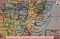
Map of Clyde Shire
-
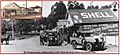
Tomerong General Store in 1927


