Tongariro Alpine Crossing facts for kids
Quick facts for kids Tongariro Alpine Crossing |
|
|---|---|

View from the summit over the Emerald Lakes, across the Central Crater, to Blue Lake. Autumn 2004.
|
|
| Length | 19.4 km (12.1 mi) |
| Location | Tongariro National Park, North Island, New Zealand |
| Trailheads | Mangatepopo Carpark Ketetahi Carpark |
| Use | Hiking |
| Highest point | Red Crater, 1,886 m (6,188 ft) |
| Lowest point | Ketetahi Carpark, 760 m (2,490 ft) |
| Difficulty | Moderate |
The Tongariro Alpine Crossing is a super popular day hike in New Zealand. It's found in Tongariro National Park, which is a special World Heritage site. This means it's important for both its amazing nature and its cultural history.
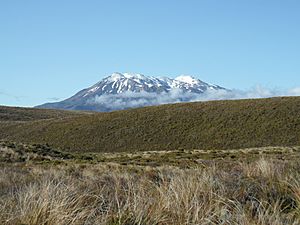
This awesome walking track takes you across the volcanic land of Mount Tongariro. This mountain is an active volcano with many craters. You'll also walk past the side of Mount Ngauruhoe.
The whole walk is about 19.4-kilometre (12.1 mi) long. It's a challenging but very rewarding adventure!
Contents
Your Adventure on the Tongariro Alpine Crossing
The Tongariro Alpine Crossing is usually walked starting from Mangatepopo. This end is higher up, at about 1,120 m (3,670 ft). You then walk down to the Ketetahi Hot Springs end, which is at 760 m (2,490 ft). This way, you do less climbing!
The walk takes about seven hours if the weather is good. It can take longer in winter or if you start from the lower Ketetahi end.
This hike is a one-way trip. You start on the west side of Mount Tongariro and finish on the north side. If you want to get back to the start, you'd need to arrange a ride. You could also walk the whole 19.4 km back, or try the longer Tongariro Northern Circuit.
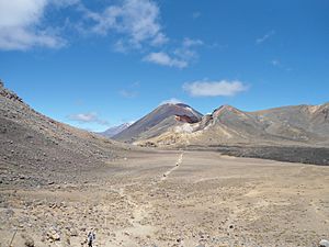
The track begins gently near the Mangatepopo Hut. Then, you climb up a steep part to the Tongariro saddle. After that, the path goes up and down into two different craters. You'll see the beautiful Emerald Lakes and walk along the edge of the Blue Lake. The last two hours of the walk are a long downhill path. You'll pass the Ketetahi Hot Springs on your way down. Watch a video about the Tongariro Alpine Crossing!
It's important to know that climbing Mount Ngauruhoe as a side trip is no longer allowed. This is because the local iwi (Māori tribe) has asked people not to climb it. The track markers for this side trip have been removed.

There is no safe drinking water on the walk. The springs in the area are often super hot and have minerals and metals from the volcanoes. Most natural water here is not safe to drink. The Ketetahi Hot Springs are privately owned and are not safe for swimming or drinking due to very hot, mineral-rich water.
Key Points and Distances on the Track
Here's a quick guide to the main points along the Tongariro Alpine Crossing:
| Point | Distance | Time | Altitude |
|---|---|---|---|
| Mangatepopo Carpark | 0.0 km (0.0 mi) | 0h 00m | 1,120 m (3,670 ft) |
| Mangatepopo Hut | 1.5 km (0.9 mi) | 0hr 25m | 1,190 m (3,900 ft) |
| Soda Springs turn-off | 1h 30m | 1,350 m (4,430 ft) | |
| South Crater | 6.4 km (4.0 mi) | 2h 30m | 1,650 m (5,410 ft) |
| Red Crater summit | 3h 30m | 1,886 m (6,188 ft) | |
| Emerald Lakes (Oturere Hut turn-off) | 9.0 km (5.6 mi) | 3h 50m | 1,695 m (5,561 ft) |
| Ketetahi Hut | 5h 15m | 1,450 m (4,760 ft) | |
| Ketetahi Carpark | 19.4 km (12.1 mi) | 7h 00m | 760 m (2,490 ft) |
Why it's Called the "Alpine" Crossing
Before 2007, the walk was just called the "Tongariro Crossing." But the name was changed to "Tongariro Alpine Crossing" to show how wild the weather can be up there. Most of the walk is on open volcanic land with no trees to protect you. This means you are fully exposed to the weather at a high altitude.
Many people walk this track each year because it's easy to get to. The New Zealand Department of Conservation wants to make sure hikers are ready for the conditions. The new name helps warn people about possible dangers. The main risks are strong winds, very cold temperatures, and sudden changes in weather. Storms can bring blinding snow and thick clouds, making it hard to see. In 2006, two people died on the track, even though about 65,000 people walked it that year. The path has poles to guide you, but in bad weather, these can be covered by snow or even blown away.
Cool Volcanic Features You'll See
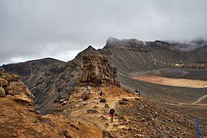
Most of your walk is through amazing volcanic land. The three volcanoes in this area are very active, and you can see this everywhere. You'll walk over hardened lava flows, loose rocks called tephra, and solidified volcanic bombs.
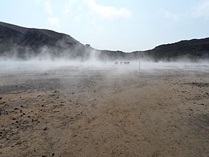
Lots of minerals come up from inside the Earth here. You can see them in the bright colors of the rocks and ridges. You'll also spot active fumaroles in many places. These are vents that constantly release steam and sulfur gas into the air. They leave yellow sulfur crystals around their edges. The lakes and pools on the walk are brightly colored by the volcanic minerals dissolved in them. Some areas even have large springs that send out almost boiling water and huge clouds of steam!
The ground you walk on is mostly sharp, new volcanic rock or loose, shifting tephra. Tephra is made of ash and small volcanic rocks. In some crater areas, the ash is finer and has become damp and packed down.
Volcanic Eruptions from Te Maari Crater
In August 2012, there was a small eruption from the Te Maari craters on Mt Tongariro. It sent ash and rocks up to 1 meter wide flying! These rocks damaged the roof of the Ketetahi hut, which is about 1.5 km from the craters. Luckily, no one was hurt. The alpine crossing was closed for a short time because about 75% of the track is within 3 km of Te Maari. Usually, the wind blows ash away from the track. When ash mixes with rain, it turns into a gritty mud.
In late November 2012, Te Maari crater erupted again. It sent an ash cloud 4,000 meters high into the sky for about 5 minutes. Around 100 people were nearby, including a group of 20 13-year-old students, but again, no one was hurt. You can see the crater from the Ketetahi area. There are no tracks leading to Te Maari because it's an unstable, active volcanic zone. The Tongariro Alpine track was closed for 4 days after this, but other tracks on the mountains stayed open. Fumaroles are still active around the edge of Te Maari crater, and you can smell a strong sulfur gas nearby.
 | William L. Dawson |
 | W. E. B. Du Bois |
 | Harry Belafonte |


