Tonopah Desert facts for kids
Quick facts for kids Tonopah Desert |
|
|---|---|
| Geography | |
| Country | United States |
| State | Arizona |
| Region | Sonoran Desert |
| District | Maricopa County |
| Borders on | Belmont Mountains & Hassayampa Plain-NE Big Horn Mountains (Arizona)-NW Interstate 10 in Arizona-S Palo Verde Hills–Gila Bend Mtns-S Harquahala Plain-SW |
| Rivers | Hassayampa River-(east & SE) Gila River-SE and Centennial Wash-(to SW) |
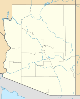
The Tonopah Desert is a cool, small desert area in Arizona, west of a big city called Phoenix, Arizona. It's part of the larger Sonoran Desert, which is famous for its unique plants and animals. This desert is located near a major highway, Interstate 10, and where two rivers, the Hassayampa River and the Gila River, meet. The desert is also just north of the Gila Bend Mountains, which create a bend in the Gila River.
The Tonopah Desert is also found northwest of the small Palo Verde Hills, near a waterway called Centennial Wash.
Contents
Exploring the Tonopah Desert
The Tonopah Desert stretches mostly from east to west. It's about 30 miles long and is surrounded by mountains that aren't too tall. To the northeast, you'll find the Belmont Mountains, which include the Hummingbird Springs Wilderness. To the west, it borders the Big Horn Mountains, where most of the Big Horn Mountains Wilderness is located.
Neighboring Plains and Washes
The Tonopah Desert sits between two other flat areas. To the northeast are the Hassayampa Plain and a narrow ridge of the Belmont Mountains. To the west and southwest, the Tonopah Desert connects to the large Harquahala Plain.
These plains and the desert are drained by important waterways called Centennial Wash and Bouse Wash. These washes help carry water through the region.
Nearby Town: Tonopah, Arizona
The closest town to the Tonopah Desert is Tonopah, Arizona. This town is located in the middle-southwest part of the desert area. It sits at an elevation of about 1,122 feet (342 meters) above sea level.
Getting Around the Tonopah Desert
Interstate 10 is a major highway that runs through the southern edge of the Tonopah Desert. The town of Tonopah, Arizona, is located right on Interstate 10, on the western side of the desert.
Important Nearby Sites
Just 5 miles southwest of Tonopah, Arizona, and south of Interstate 10, is a place called Wintersburg, Arizona. This is where the Palo Verde Nuclear Generating Station is located. It's a very important power plant that generates electricity.
Roads for Exploring
From Interstate 10, there are dirt roads that go north into the desert. One of these is 355th Avenue, located to the west. To the east, you'll find the Sun Valley Parkway, which leads to areas northwest of Phoenix and Glendale.
Protecting the Desert Environment
The Tonopah Desert area is home to the Hummingbird Springs Wilderness, a special place for nature. Because people have used a lot of water from underground, there are now projects to help put water back into the ground. These projects aim to protect the Tonopah Aquifer, which is like a giant underground sponge that holds water.
The Tonopah Desert Recharge Project
One important project is the Tonopah Desert Recharge Project. It's part of the Central Arizona Project and is located in the Lower Hassayampa Basin. This project started building 19 special basins in 2004. These basins help water soak back into the ground. The project officially began working in 2006, helping to reverse the effects of too much water being used.
 | Sharif Bey |
 | Hale Woodruff |
 | Richmond Barthé |
 | Purvis Young |


