Belmont Mountains facts for kids
Quick facts for kids Belmont Mountains |
|
|---|---|
| Highest point | |
| Peak | Sugarloaf Mountain (Arizona)-(in northwest) (Belmont Mountains) |
| Elevation | 3,418 ft (1,042 m) |
| Dimensions | |
| Length | 25 mi (40 km) NW-SE |
| Width | 8 mi (13 km) |
| Geography | |
| Country | United States |
| State | Arizona |
| Region | (north-central)-Sonoran Desert |
| District | Maricopa County, AZ |
| Settlement | Aguila, AZ–Tonopah, AZ |
| Range coordinates | 33°38′41″N 112°56′00″W / 33.64476°N 112.93324°W |
| Borders on | Hassayampa Plain-NE Big Horn Mountains (Arizona)-SW Tonopah Desert-S |
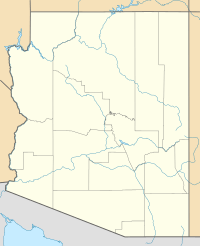
The Belmont Mountains are a mountain range in Arizona, USA. They are about 25 miles (40 km) long. You can find them about 50 miles west of Phoenix, Arizona. These mountains are part of the northern Sonoran Desert. They are located just north of the Gila River. Nearby, there are two dry riverbeds called washes. The Bouse Wash flows northwest towards the Colorado River. The Centennial Wash flows southeast to meet the Gila River.
Contents
About the Belmont Mountains
What do they look like?
The Belmont Mountains stretch from the northwest to the southeast. They are mostly made up of low hills. At their western end, the range curves towards the west. They are partly connected to the Big Horn Mountains. These mountains are located to the southwest.
Between the Belmont and Big Horn ranges is the Hummingbird Springs Wilderness. A wilderness area is a special protected natural space. This wilderness covers a large part of the Belmont Mountains' northwest side. It also covers the northeast half of the Big Horn Mountains. The rest of the Big Horn Mountains is mostly the Big Horn Mountains Wilderness. Valleys are found on both sides of these mountain ranges. One valley is to the northeast, and another is to the southwest.
What is the highest point?
The tallest peak in the Belmont Mountains is Sugarloaf Mountain. It stands at 3,418 feet (1,042 meters) high. You can find it at 33°40′39″N 113°05′14″W / 33.67756°N 113.08736°W. This peak is on the northeast edge of the Hummingbird Springs Wilderness. The very center of the Belmont Mountains is at Belmont Mountain itself. Its coordinates are 33°38′41″N 112°56′00″W / 33.644758°N 112.933236°W.
How to visit the Belmont Mountains
You can reach the northern part of the Belmont Mountains from Aguila, Arizona. This town is located on U.S. Route 60 in Arizona. To get to the southern part of the range, you can use Interstate 10 in Arizona. This highway is near the town of Tonopah.
 | Selma Burke |
 | Pauline Powell Burns |
 | Frederick J. Brown |
 | Robert Blackburn |


