Sugarloaf Mountain (Arizona) facts for kids
Quick facts for kids Sugarloaf Mountain |
|
|---|---|

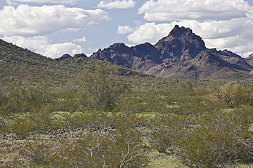
Sugarloaf Mountain in the Hummingbird Springs Wilderness
|
|
| Highest point | |
| Elevation | 3,420 ft (1,042 m) NGVD 29 |
| Prominence | 1,188 ft (362 m) |
| Geography | |
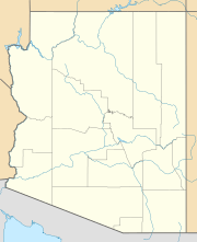
| Location | Maricopa County, Arizona, U.S. |
| Topo map | USGS Hummingbird Spring |
Sugarloaf Mountain is a tall peak located in Arizona. It is the highest point in the Hummingbird Springs Wilderness. This wilderness area is a dry, low-lying region in northwest Maricopa County. Sugarloaf Mountain is about 65 miles (105 km) west of Phoenix.
The mountain stands in the Tonopah Desert. It is about 10 miles (16 km) northwest of the Belmont Mountains.
Location and Nearby Areas
The Hummingbird Springs Wilderness is located just north of the Big Horn Mountains Wilderness. These two wilderness areas are very close. They are separated only by a small jeep trail. This trail leads to a place called Hummingbird Springs.
Waterways Around the Mountain
The small streams and dry riverbeds, known as washes, around Sugarloaf Mountain flow into Tiger Wash. Tiger Wash flows southwest and is located southeast of the Harquahala Mountains.
Tiger Wash is a smaller stream that feeds into Centennial Wash. Centennial Wash flows southeast through Maricopa County. Finally, Centennial Wash is a tributary to the larger Gila River. This means its waters eventually join the Gila River.
 | William L. Dawson |
 | W. E. B. Du Bois |
 | Harry Belafonte |


