Tormantos facts for kids
Quick facts for kids
Tormantos
|
|
|---|---|

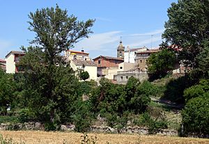
Skyline of Tormantos
|
|
| Country | |
| Autonomous community | |
| Comarca | Santo Domingo de la Calzada |
| Area | |
| • Total | 11.07 km2 (4.27 sq mi) |
| Elevation | 608 m (1,995 ft) |
| Population
(2018)
|
|
| • Total | 139 |
| Demonym(s) | tormantino, na |
| Postal code |
26213
|
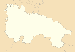
Tormantos is a small town, also called a municipality, in the region of La Rioja in Spain. It is located in the western part of La Rioja. This area is known as Rioja Alta. Tormantos is right on the border with the province of Burgos.
The town sits in the flat, fertile valley of the Tirón river. It is the first town along the river where you can cross it.
Contents
A Look at Tormantos' History
Early Records and Royal Ties
The first time Tormantos is mentioned in history books is in the year 1137. This was in a document where a local person, Don Blasco Álvarez, gave a vineyard to Santo Domingo de la Calzada.
A few years later, in 1146, King Alfonso VII included Tormantos in a special law document. This document was called a Fuero and was for the nearby village of Cerezo. A Fuero was like a set of rules or rights given to a town by a king. Cerezo later became independent during the time of King Charles III of Spain.
Another old document from 1269 shows that Don Simón Roiz gave all his property in Tormantos to his wife, Sancha Alfonso. She was the daughter of the king of the León.
The Camino de Santiago and Population
For a long time, until the 12th century, a famous pilgrimage route passed through Tormantos. This route was the French Way of the Camino de Santiago. It followed the path of an old Roman road. Later, the route was changed and moved to Santo Domingo, which is where it goes today.
In the 16th century, a count of the population was done for the Kingdom of Castille. Tormantos was listed as having about 200 people. It was part of the Archdiocese of Burgos.
Places to See in Tormantos
Tormantos has some interesting historical buildings.
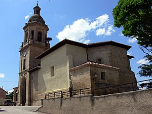
- Parish Church of San Esteban Protomártir: This is the main church in the town.
- Palace of Ruy López Dávalos: This old palace belonged to a famous person named Ruy López Dávalos.
See also
 In Spanish: Tormantos para niños


