
Toronto, Iowa facts for kids
Quick facts for kids
Toronto, Iowa
|
|
|---|---|

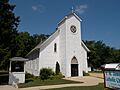
Saint James Catholic Church
|
|

Location of Toronto, Iowa
|
|
| Country | United States |
| State | Iowa |
| County | Clinton |
| Incorporated | July 26, 1909 |
| Named for | Toronto, Ontario, Canada |
| Area | |
| • Total | 0.18 sq mi (0.47 km2) |
| • Land | 0.18 sq mi (0.47 km2) |
| • Water | 0.00 sq mi (0.00 km2) |
| Elevation | 722 ft (220 m) |
| Population
(2020)
|
|
| • Total | 102 |
| • Density | 560.44/sq mi (215.85/km2) |
| Time zone | UTC-6 (Central (CST)) |
| • Summer (DST) | UTC-5 (CDT) |
| ZIP code |
52777
|
| Area code(s) | 563 |
| FIPS code | 19-78600 |
| GNIS feature ID | 0462280 |
Toronto is a small town located in Clinton County, Iowa, in the United States. It's a very small community, with only 102 people living there according to the 2020 census. The town is named after the much larger city of Toronto, Ontario, in Canada.
Contents
History of Toronto, Iowa
Toronto was officially planned and laid out in 1853. A man named George W. Thorne, who was born in England and grew up in Toronto, Ontario, Canada, started the town.
Before the town was even planned, Thorne had already built a sawmill and a gristmill in the area during the 1840s. These mills were important for processing wood and grain for the local community.
Geography and Location
Toronto is located in eastern Iowa. Its exact position is 41 degrees, 54 minutes, 12 seconds North and 90 degrees, 51 minutes, 47 seconds West. The town is completely surrounded by Liberty Township.
The United States Census Bureau reports that Toronto covers a total area of about 0.19 square miles (0.47 square kilometers). All of this area is land, meaning there are no large lakes or rivers within the town limits.
Population Changes Over Time
| Historical populations | ||
|---|---|---|
| Year | Pop. | ±% |
| 1910 | 106 | — |
| 1920 | 139 | +31.1% |
| 1930 | 113 | −18.7% |
| 1940 | 142 | +25.7% |
| 1950 | 165 | +16.2% |
| 1960 | 144 | −12.7% |
| 1970 | 145 | +0.7% |
| 1980 | 172 | +18.6% |
| 1990 | 132 | −23.3% |
| 2000 | 134 | +1.5% |
| 2010 | 124 | −7.5% |
| 2020 | 102 | −17.7% |
| Source: and Iowa Data Center Source: |
||
The number of people living in Toronto has changed quite a bit over the years. The town's population reached its highest point in 1980, with 172 residents. Since then, the population has slowly decreased.
2020 Census Details
In 2020, the census counted 102 people living in Toronto. There were 48 households and 37 families in the town. This means there were about 559 people per square mile (215.9 people per square kilometer).
Most of the people in Toronto were White, making up about 90.2% of the population. About 8.8% of residents identified as being from two or more races. A small number, 3.9%, were of Hispanic or Latino background.
About 29.2% of households had children under 18 living with them. The average age of people in Toronto was 45 years old. About 20.6% of residents were under 20 years old, and 29.4% were 65 years or older. The town had a nearly even split between males (51.0%) and females (49.0%).
2010 Census Details
The census in 2010 recorded 124 people living in Toronto. There were 48 households and 36 families. The population density was about 652.6 people per square mile (251.9 people per square kilometer).
At that time, 97.6% of the population was White, and 2.4% was African American. About 2.4% of residents were of Hispanic or Latino background.
About 27.1% of households had children under 18. The average age in the town was 47 years. About 21.8% of residents were under 18, and 12.9% were 65 or older. The town had slightly more males (54.0%) than females (46.0%).
Education in Toronto
Students in Toronto attend public schools operated by the Calamus–Wheatland Community School District. This school district was formed in 1990 when the Calamus and Wheatland school districts joined together. Calamus–Wheatland High School is the local high school for students in the area.
Images for kids
-
Saint James Catholic Church
-

Location of Toronto, Iowa
See also
 In Spanish: Toronto (Iowa) para niños
