Toxaway River facts for kids
Quick facts for kids Toxaway River |
|
|---|---|
|
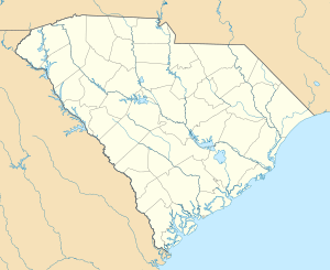
Location of Toxaway River mouth
|
|
| Other name(s) | Tributary to Keowee River |
| Country | United States |
| State | North Carolina South Carolina |
| Counties | Transylvania (NC) Oconee (SC) Pickens (SC) |
| Physical characteristics | |
| Main source | divide between Toxaway River and Greenland Creek about 0.5 miles southeast of Cold Mountain Gap 4,000 ft (1,200 m) 35°09′03″N 082°59′21″W / 35.15083°N 82.98917°W |
| River mouth | Keowee River (Lake Jocassee) Lake Jocassee 1,108 ft (338 m) 34°58′36″N 082°56′05″W / 34.97667°N 82.93472°W |
| Length | 21.31 mi (34.30 km) |
| Basin features | |
| Progression | generally south |
| River system | Savannah River |
| Basin size | 146.73 square miles (380.0 km2) |
| Tributaries |
|
| Waterfalls | Toxaway Falls |
| Bridges | Long Ridge Road, Cardinal Drive, Cold Mountain Road, NC 281 |
The Toxaway River is a river that flows for about 21.4-mile (34.4 km) (around 34 kilometers). It starts high up in the mountains of Transylvania County, North Carolina. As it travels south, it flows into Lake Toxaway and then tumbles over the beautiful Toxaway Falls.
After the falls, the river crosses into South Carolina. It eventually empties into Lake Jocassee, which is a large lake created by a dam. Inside Lake Jocassee, the Toxaway River meets another river called the Whitewater River. Together, they form the Keowee River. The spot where they join is now underwater, hidden by Lake Jocassee.
The Toxaway River is part of a much larger river system. Its waters flow from the Keowee River into the Seneca River, and finally into the mighty Savannah River. This means the water from the Toxaway River eventually makes its way all the way to the Atlantic Ocean!
Contents
Where the Toxaway River Begins
The Toxaway River starts in the mountains of North Carolina. Its very beginning, called its headwaters, is near a place called Cold Mountain Gap. Here, the river starts as tiny streams fed by rain and melting snow. The elevation at its source is about 4,000 ft (1,200 m) (1,219 meters) above sea level.
The Journey of the River
As the Toxaway River flows, it generally moves towards the south. It picks up water from many smaller streams and creeks along the way. These smaller waterways are called tributaries.
Tributaries Joining the Toxaway
Many smaller creeks add their water to the Toxaway River.
- On its left side, it is joined by:
- Indian Creek
- Panther Branch
- Auger Fork
- Toxaway Creek
- Rock Creek
- Laurel Fork Creek
- Devils Hole Creek
- On its right side, it is joined by:
- Mill Creek
- Deep Ford Creek
- Bear Meadow Creek
- Cobb Creek
- Horsepasture River
Toxaway Falls: A Natural Wonder
One of the most famous spots along the river is Toxaway Falls. This is where the river drops dramatically, creating a beautiful waterfall. Waterfalls are important parts of a river's journey, showing how the land changes.
Bridges Over the River
Several roads cross over the Toxaway River as it flows. These bridges help people travel and connect communities. Some of the roads with bridges over the river include:
- Long Ridge Road
- Cardinal Drive
- Cold Mountain Road
- NC 281
The End of the Journey: Lake Jocassee
The Toxaway River's journey ends when it flows into Lake Jocassee. This lake is a large reservoir, which is a human-made lake built to store water. The lake is formed by the Lake Jocassee Dam. The elevation where the river enters the lake is about 1,108 ft (338 m) (338 meters) above sea level.
 | Shirley Ann Jackson |
 | Garett Morgan |
 | J. Ernest Wilkins Jr. |
 | Elijah McCoy |


