Traeth Mawr facts for kids

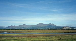
Traeth Mawr means "big sands" in Welsh. It is a special area of land in Gwynedd, Wales, near Porthmadog. This land is a type of polder, which means it used to be under water but was later drained and protected from the sea.
Long ago, Traeth Mawr was a large estuary (where a river meets the sea) for the Afon Glaslyn river. It had a lot of sand and mud that the tides covered. People created this dry land by reclaiming it from the sea in the late 1700s and early 1800s. A huge wall, called the Cob, now keeps the sea out. This wall also holds a road and a railway line.
History
Early Efforts
The Afon Glaslyn estuary was a very dangerous place. Many stories say that people died in the quicksands while trying to cross Traeth Mawr.
In the late 1700s, people who owned land nearby started to reclaim small parts of the estuary. They built walls to keep the water out. Between 1770 and 1800, they created about 1,500 acres (600 hectares) of new land this way.
Around 1798, a man named William Madocks bought land near Penmorfa Marsh. He soon started a bigger project. He built a 2-mile (3.2 km) long earth wall from Prenteg to what is now Porthmadog. He then founded the town of Tremadog on this new land. A simple railway with wooden tracks helped build this wall.
Building The Cob
In 1807, William Madocks got special permission from the government. This allowed him to finish reclaiming Traeth Mawr. From 1808 to 1811, he built a massive wall called "the Cob." This wall stretched from Ynys Towyn (now part of Porthmadog) to Boston Lodge.
The Cob is a huge earth wall, strengthened with stone. It is 1,600 yards (1,463 meters) long. It is 90 feet (27 meters) wide at the bottom and 18 feet (5.5 meters) wide at the top. The top of the Cob is 21 feet (6.4 meters) above the river. This huge project finished reclaiming another 1,500 acres (600 hectares) of Traeth Mawr.
Soon after it was finished in 1812, a big storm damaged the Cob. Repairs were completed by September 1814. Building the Cob was very expensive. It was first estimated to cost £23,500. But it ended up costing Madocks £60,000. This would be like tens of millions of pounds today! At its end near the sea, Traeth Mawr connects to "Traeth Bach," which means "little sands." This is the estuary of the River Dwyryd.
Getting Around
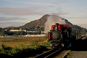
In 1836, the Ffestiniog Railway started using The Cob. They built a special track to carry slate from quarries in Blaenau Ffestiniog to Porthmadog. There, the slate was loaded onto ships. Horses pulled empty wagons back up to the quarries. Loaded wagons rolled downhill by themselves across The Cob. In 1863, the railway was improved to a narrow gauge railway. In 1927, the Cob was damaged again and took months to fix.
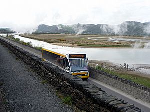
A road was also built on the lower, inland side of the Cob for public use. For many years, drivers had to pay a toll (a fee) to cross the Cob. This often caused long traffic jams, especially during holidays. Sometimes, lines of cars stretched for a mile in each direction. In 2003, the Welsh Assembly Government bought The Cob, and the toll was removed.
In 2002, the road across the Cob was made wider. A separate path was added for people walking and cycling. This path is now part of Lôn Las Cymru, a national cycle route.
In 2010, work began on a new bypass road around Porthmadog. This new road helps reduce traffic going through the town. After the bypass was finished, the road across The Cob was given a new number, the A4971.
In 2012, part of the Cob was widened on the side facing the sea. This allowed the Ffestiniog & Welsh Highland Railway to build a second platform at their Harbour Station.
Images for kids
 | Roy Wilkins |
 | John Lewis |
 | Linda Carol Brown |


