Transportation in Houston facts for kids
Houston is a big city, and getting around is super important! This article will tell you all about how people travel in Houston, from the busy roads to public buses, trains, and even airports and seaports.
Houston has a special road system that looks a bit like a spider web or a bicycle wheel. It has a center and then loops that go around it.
Contents
Roads and Highways
The main highway system in Houston uses a "hub-and-spoke" design. This means there's a center point, and roads spread out from it like spokes on a wheel. Then, there are big loops that go around the city.
- The first loop is Interstate 610, often called "Loop 610." It's about 10 miles across and circles the downtown area. This loop is divided into North, South, West, and East sections.
- The next big loop is Beltway 8, which is also known as the Sam Houston Tollway. This loop is much larger, about 25 miles across.
- A third, even bigger loop is being built called State Highway 99, or "The Grand Parkway." Parts of it are already finished, and it will eventually form a huge circle outside Houston.
Houston is also part of a big highway project called Interstate 69. This highway will connect Canada, the central U.S., Texas, and Mexico.
Mass Transit
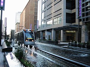
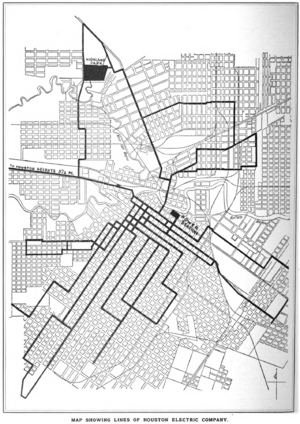
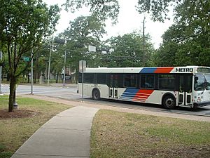
The main public transportation system in Houston is called METRO. It offers different ways to get around, including buses, trolleys, and special vans.
METRO also has a light rail system called METRORail. It started running on January 1, 2004. The main track is about 13 miles long. It connects Downtown Houston to places like the Texas Medical Center and Reliant Park to the south, and to the Northline Mall to the north.
METRO also has a great "park-and-ride" bus system. You can drive your car to a special parking lot outside the city, park it, and then take a bus directly to major work areas. Many of these buses use special lanes called HOV lanes, which are only for buses and cars with many passengers. This helps them avoid traffic.
METRO is planning to add five more sections to the rail system in the future. One expansion will go from Uptown through Texas Southern University to the University of Houston campus.
Airports
Houston has two main commercial airports where you can catch flights:
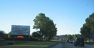
- The biggest one is the George Bush Intercontinental Airport (IAH). It's one of the busiest airports in the United States and even worldwide! Many flights take off from here every day, including lots of United Airlines flights, as it's a major hub for them. This airport connects Houston to many places both inside and outside the U.S.
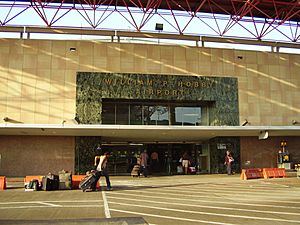
- The second largest airport is the William P. Hobby Airport. It was named Houston International Airport until 1967. This airport mainly handles shorter and medium-length flights. It's the only airport in Houston served by Southwest Airlines.
There's also a third airport called Ellington Airport. It used to be a U.S. Air Force base and is now mostly used for government and private planes.
The Houston Airport System, which manages these airports, was named "Airport of the Year" in 2005. This was because they spent a lot of money to make both major airports better.
Intercity Rail
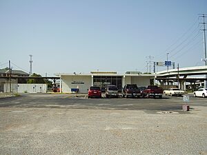
If you want to travel by train to other cities, Amtrak has a train called the "Sunset Limited" that stops in Houston. This train travels between Los Angeles and New Orleans three times a week. The Houston train station is located on the north side of downtown.
Amtrak also has a bus service called "Amtrak Thruway" that connects Houston to another train line, the "Texas Eagle," in a city called Longview. This allows people from Houston to connect to trains going to Chicago or San Antonio.
There's also a plan for a new high-speed rail line called the Texas Central Railway. It would connect Houston and Dallas and is expected to start service around 2026.
Intercity Bus
Several bus companies offer rides from Houston to other cities. Greyhound Lines is one of the most well-known. They have several stations in Houston, including a main one in Midtown.
Other bus companies like Megabus, El Expreso Bus Company, and Tornado Bus Company also operate services from Houston to major cities in Texas, Louisiana, and Mexico. Megabus uses large double-decker buses for low-cost travel.
Seaport
Houston is also a very important city for shipping goods by sea.
- The Port of Houston is one of the busiest ports in the United States. It handles a huge amount of cargo, especially foreign goods. In 2013, over 229 million tons of cargo passed through this port!
- The Port of Galveston is another important port nearby. It's a major place for cruise ships and passenger boats. Many people start their cruises from Galveston.
Pedestrian Travel
Walking around Houston can be tricky because the city is very spread out and designed mostly for cars. Between 2003 and 2008, many pedestrians were injured or died in crashes in the Houston area.
However, things are changing! In 2013, Mayor Annise Parker announced the "Houston Complete Street and Transportation Plan." This plan aims to make streets safer and better for people who walk and bike when new roads are built or old ones are fixed.
Thanks to this plan and another project called "ReBuild Houston," the city now has over 300 miles of bike lanes, bike routes, and trails. This makes it easier and safer for people to get around on foot or by bicycle.
Demographics by Mode of Travel
Most people in Houston use cars to get around. However, public transportation is very important for many residents.
In 1995, a survey found that 76% of people who rode METRO buses did so because they didn't have any other way to travel. For people who stopped riding the bus, 46% had bought or fixed a car.
In 1997, about 9% of people in Harris County (where Houston is located) did not own a car. For those without cars, the average commute to work was 44 minutes, which is much longer than the 25-minute average for people who drive.
Some people who are new to the city or don't have much money often rely on bicycles, or get rides from family and friends.
Parking Requirements
Houston's City Council recently made a change to how parking works in some parts of the city. They passed a new rule that allows certain areas, like East Downtown and parts of Midtown, to have "market-based parking."
This means that in these areas, new buildings don't have to provide a set number of parking spaces. Instead, developers can decide how much parking to build based on what they think people will need.
People who supported this change believe that having fewer required parking spaces will:
- Reduce too much empty parking space.
- Make the city less focused on cars.
- Make it easier for people to walk, bike, or use public transportation.
However, some people were worried. They thought that getting rid of parking requirements might lead to a shortage of parking, making it hard for customers to visit businesses. Others felt that the new rule didn't go far enough and wished more areas of the city would adopt market-based parking.
 | Lonnie Johnson |
 | Granville Woods |
 | Lewis Howard Latimer |
 | James West |


