Trappers Lake facts for kids
Quick facts for kids Trappers Lake |
|
|---|---|

June 2005
|
|
| Location | Flat Tops Wilderness Area, Garfield County, Colorado, US |
| Coordinates | 39°59′10″N 107°13′52″W / 39.986°N 107.231°W |
| Primary outflows | North Fork of the White River |
| Basin countries | United States |
| Max. length | 2.4 km (1.5 mi) |
| Max. width | 800 m (2,600 ft) |
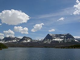
Trappers Lake is a beautiful lake located in the Flat Tops Wilderness Area in Colorado, United States. It's part of the White River National Forest. This amazing lake sits high up, about 9,600 feet (2,900 meters) above sea level. It's also the starting point for the North Fork of the White River.
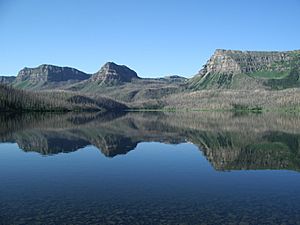
Trappers Lake is found in Garfield County, between the towns of Meeker and Yampa. It's about 1.5 miles (2.4 km) long and half a mile (800 m) wide. The lake reaches depths of 180 feet (55 m). It is surrounded by the Flat Tops Mountains. The most striking mountain nearby is the large semicircular Amphitheater, which rises 1,650 feet (503 m) high. Trappers Lake is the second-largest natural lake in Colorado, after Grand Lake.
Contents
Discover Trappers Lake
Trappers Lake is a special place in the Rocky Mountains. It is known for its clear waters and stunning natural beauty. The lake is a key part of the Flat Tops Wilderness Area. This means the area is kept wild and undeveloped.
Fun Activities at the Lake
There is a large camping area and a lodge near Trappers Lake. Many people visit to enjoy the outdoors. The lake is famous for its excellent fishing. You can catch cutthroat trout here.
Fishing Rules
When fishing for cutthroat trout, you must release them back into the water. This helps protect the fish population. However, you can keep brook trout if you catch them. Only artificial flies and lures are allowed for fishing. This rule helps keep the lake clean and healthy. Also, no motorized boats are allowed on the lake. This helps keep the water quiet and peaceful.
A Wildfire's Impact
In July 2002, a large wildfire called the Big Fish fire happened. It was started by lightning. About 17,000 acres (69 square kilometers) of forest around the lake were burned. This fire changed the landscape around Trappers Lake. However, nature slowly recovers over time.
Protecting Trappers Lake
The area around Trappers Lake has a special history of protection. In 1920, a man named Arthur Carhart was hired by the Forest Service. He was supposed to plan a road around the lake. But Carhart saw how beautiful and important the area was. He recommended that it should be kept wild instead.
Because of Carhart's recommendation, the area was largely protected from development. This was the first time a Forest Service property was set aside in this way. Many people consider Trappers Lake to be the birthplace of the U.S. Wilderness Area system. This system protects wild places across the United States. It ensures they remain natural for future generations to enjoy.
 | Jewel Prestage |
 | Ella Baker |
 | Fannie Lou Hamer |


