Triangle, New York facts for kids
Quick facts for kids
Triangle, New York
|
|
|---|---|

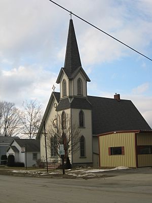
Grace Episcopal Church in Whitney Point
|
|

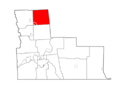
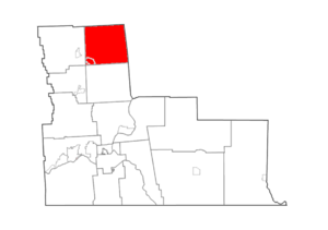
Map highlighting Triangle's location within Broome County.
|
|
| Country | United States |
| State | New York |
| County | Broome |
| Government | |
| • Type | Town Council |
| Area | |
| • Total | 39.78 sq mi (103.03 km2) |
| • Land | 37.88 sq mi (98.10 km2) |
| • Water | 1.91 sq mi (4.94 km2) |
| Elevation | 1,388 ft (423 m) |
| Population
(2010)
|
|
| • Total | 2,946 |
| • Estimate
(2016)
|
2,841 |
| • Density | 75.01/sq mi (28.96/km2) |
| Time zone | UTC-5 (Eastern (EST)) |
| • Summer (DST) | UTC-4 (EDT) |
| FIPS code | 36-007-75319 |
| GNIS feature ID | 0979557 |
Triangle is a town located in Broome County, New York, United States. In 2010, about 2,946 people lived there. The main community in the town is the village of Whitney Point.
The town is in the northeastern part of Broome County. It is located north of the city of Binghamton.
Contents
Discovering the History of Triangle
The area that is now Triangle was first settled around 1791. The town of Triangle was officially created in 1831. It was formed from a part of the town of Lisle. Before it became Triangle, this area was known as the "Chenango Triangle."
In 1871, the community of Whitney Point became an official village within the town. This meant it had its own local government.
Exploring Triangle's Geography
According to the United States Census Bureau, the town of Triangle covers a total area of about 103 square kilometers (39.8 square miles). Most of this area, about 98.1 square kilometers (37.9 square miles), is land. The remaining 4.9 square kilometers (1.9 square miles) is water.
The Tioughnioga River flows through the southwestern part of the town. This river is a branch of the larger Susquehanna River.
The eastern border of the town is shared with Chenango County. The northern border touches Cortland County.
Several important roads pass through Triangle. New York State Route 206 runs east-west. New York State Route 26 goes north-south along the eastern side of the Whitney Point Reservoir. Also, Interstate 81, U.S. Route 11, and New York State Route 79 all cross the southwestern corner of the town near Whitney Point.
Population of Triangle
| Historical population | |||
|---|---|---|---|
| Census | Pop. | %± | |
| 1840 | 1,692 | — | |
| 1850 | 1,728 | 2.1% | |
| 1860 | 1,693 | −2.0% | |
| 1870 | 1,944 | 14.8% | |
| 1880 | 2,073 | 6.6% | |
| 1890 | 1,879 | −9.4% | |
| 1900 | 1,727 | −8.1% | |
| 1910 | 1,600 | −7.4% | |
| 1920 | 1,458 | −8.9% | |
| 1930 | 1,452 | −0.4% | |
| 1940 | 1,575 | 8.5% | |
| 1950 | 1,733 | 10.0% | |
| 1960 | 2,019 | 16.5% | |
| 1970 | 2,285 | 13.2% | |
| 1980 | 2,618 | 14.6% | |
| 1990 | 3,006 | 14.8% | |
| 2000 | 3,032 | 0.9% | |
| 2010 | 2,946 | −2.8% | |
| 2016 (est.) | 2,841 | −3.6% | |
| U.S. Decennial Census | |||
In 2000, there were 3,032 people living in the town of Triangle. These people lived in 1,131 households. About 809 of these households were families.
The population density was about 79.6 people per square mile. There were 1,245 homes in total.
The average household had about 2.68 people. The average family had about 3.14 people.
In terms of age, about 29.5% of the population was under 18 years old. About 11.4% of the population was 65 years old or older. The average age in the town was 36 years.
Communities and Places in Triangle
- Barnes Corners – This is a place in the northeastern part of the town. It is north of the small community called Triangle.
- Clough Corners – A small community, also known as a hamlet. It is located near the northern border of the town on County Road 144.
- Hazzard Corners – This location is found to the east of Clough Corners.
- Page Brook – A stream that flows into the Whitney Point Reservoir.
- Penelope – A location situated right on the northern town line.
- Triangle – This is a small community or hamlet. It is in the southern part of the town, located on NY Route 206 where it meets County Road 133.
- Upper Lisle – A hamlet found at the northern end of the Whitney Point Reservoir on NY-26.
- Whitney Point – This is the main village in the town. It is in the southwestern part of Triangle, close to I-81 and US-11.
- Whitney Point Reservoir – This is a man-made lake on the western side of the town. It was created on the Otselic River, which is a branch of the Tioughnioga River.
See also
 In Spanish: Triangle (Nueva York) para niños
 | Dorothy Vaughan |
 | Charles Henry Turner |
 | Hildrus Poindexter |
 | Henry Cecil McBay |


