Lisle, New York facts for kids
Quick facts for kids
Lisle, New York
|
|
|---|---|
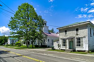
Main Street
|
|
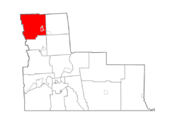
Map highlighting Lisle's location within Broome County.
|
|
| Country | United States |
| State | New York |
| County | Broome |
| Government | |
| • Type | Town Council |
| Area | |
| • Total | 46.98 sq mi (121.69 km2) |
| • Land | 46.89 sq mi (121.45 km2) |
| • Water | 0.09 sq mi (0.23 km2) |
| Population
(2010)
|
|
| • Total | 2,751 |
| • Estimate
(2016)
|
2,677 |
| • Density | 57.09/sq mi (22.04/km2) |
| Time zone | UTC-5 (Eastern (EST)) |
| • Summer (DST) | UTC-4 (EDT) |
| FIPS code | 36-007-42653 |
Lisle is a small town located in Broome County, New York, in the United States. In 2010, about 2,751 people lived here.
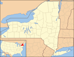
The town of Lisle is in the northwestern part of Broome County. It is located north of the city of Binghamton. Inside the town of Lisle, there is also a smaller area called the village of Lisle.
Contents
History of Lisle
Early Settlement and Growth
The area that is now the town of Lisle was first settled around the year 1791. The town itself was officially formed in 1801. It was created from a larger area known as the town of Union.
Over time, parts of Lisle were used to create new towns. In 1831, Lisle was divided into four sections. This led to the creation of three new towns: Barker, Nanticoke, and Triangle.
Some of the first European settlers in 1791 included Josiah Patterson and Ebenezer Tracy. By 1830, Lisle was a busy place with a population of 4,393 people. This was more than any other town in Broome County at the time.
Lisle as a Manufacturing Hub
Lisle was once a major shopping center. Many goods were made in its mills and sold in the busy area called "Center Lisle." This area was originally known as Yorkshire.
In 1835, Lisle was well-known for its manufacturing. It had many different types of mills and factories:
- Three gristmills (for grinding grain)
- Twenty sawmills (for cutting wood)
- One oil cloth mill
- Three fulling mills (for making cloth thicker)
- Three carding mills (for preparing wool)
- One trip hammer or forging mill (for shaping metal)
- Three tanneries (for making leather)
- Two places where potash was made (a chemical used in soap and fertilizer)
Population Changes and Challenges
About 46 years later, in 1876, Lisle's population dropped a lot, to only 400 people. The exact reason for this big decline is not fully known, but a flood might have played a part.
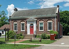
In January 1918, a special event happened in Lisle. Florence B. Chauncey became the first woman in New York State to vote. This historic vote took place at the Lisle Village Hall. In 2018, a special marker was put up at the Village Hall to remember this important moment.
In 1915, a home for children called "Happy Valley Homes" was started in the town.
A major flood in 1935 caused a lot of damage to the town. Even today, items from the 1935 flood are sometimes found and shown at the Maple Festival in Marathon. To prevent future floods, dikes and other flood control projects were built along the Tioughnioga River. This work, along with the Whitney Point dam, helps protect the area.
Lisle's history has seen its population go up and down. However, in recent times, the population has started to increase slightly again.
Geography of Lisle
The town of Lisle covers a total area of about 121.7 square kilometers (about 47 square miles). Most of this area is land, with only a small part being water.
The northern border of Lisle touches Cortland County. The western border is shared with Tioga County.
The Tioughnioga River flows through the town. Whitney Point Lake is located just east of Lisle's eastern border. Important roads like Interstate 81 and U.S. Route 11 run north and south through the town. New York State Route 79 is a key east-west highway. A small part of New York State Route 26 also crosses the southeastern corner of the town.
Lisle is also home to a natural artesian spring, which means water flows up from the ground on its own.
Population and People
| Historical population | |||
|---|---|---|---|
| Census | Pop. | %± | |
| 1820 | 3,083 | — | |
| 1830 | 4,393 | 42.5% | |
| 1840 | 1,560 | −64.5% | |
| 1850 | 1,680 | 7.7% | |
| 1860 | 1,791 | 6.6% | |
| 1870 | 2,525 | 41.0% | |
| 1880 | 2,399 | −5.0% | |
| 1890 | 1,962 | −18.2% | |
| 1900 | 1,710 | −12.8% | |
| 1910 | 1,429 | −16.4% | |
| 1920 | 1,219 | −14.7% | |
| 1930 | 1,299 | 6.6% | |
| 1940 | 1,397 | 7.5% | |
| 1950 | 1,534 | 9.8% | |
| 1960 | 1,587 | 3.5% | |
| 1970 | 1,917 | 20.8% | |
| 1980 | 2,039 | 6.4% | |
| 1990 | 2,486 | 21.9% | |
| 2000 | 2,707 | 8.9% | |
| 2010 | 2,751 | 1.6% | |
| 2016 (est.) | 2,677 | −2.7% | |
| U.S. Decennial Census | |||
According to the 2000 census, there were 2,707 people living in Lisle. These people made up 971 households and 726 families. The population density was about 57.7 people per square mile.
Most of the people living in Lisle were White (98.37%). A small percentage were African American, Native American, or Asian. About 0.33% of the population identified as Hispanic or Latino.
In terms of age, about 29.6% of the population was under 18 years old. About 10.5% were 65 years or older. The average age in Lisle was 35 years.
The average income for a household in Lisle was $34,240 per year. For families, the average income was $37,639. About 15% of the population lived below the poverty line.
Communities and Locations in Lisle
The town of Lisle includes several smaller communities and hamlets:
- Center Lisle – This is a small community in the middle of the town, located on NY Route 79. It was once called "Yorkshire."
- Killawog – This community is in the northeastern part of the town, near Interstate 81. It was originally known as "Union Village."
- Lisle – This is the main village within the eastern part of the town.
- Manningsville – A community located on NY-79 in the southeastern part of the town.
It's important to note that the community of Upper Lisle is actually located in the nearby town of Triangle, not in the town of Lisle itself.
See also
 In Spanish: Lisle (pueblo) para niños
 | Mary Eliza Mahoney |
 | Susie King Taylor |
 | Ida Gray |
 | Eliza Ann Grier |


