Tsada facts for kids
Quick facts for kids
Tsada
Τσάδα
Tsadha
|
|
|---|---|
 |
|
| Country | |
| District | Paphos District |
| Elevation | 612 m (1,988 ft) |
| Highest elevation | 627 m (2,057 ft) |
| Population
(2021)
|
|
| • Total | 1,180 |
| Time zone | UTC+2 (EET) |
| • Summer (DST) | UTC+3 (EEST) |
| Postal code |
8540
|
| Area code(s) | 6120 |
| Climate | Csa (Hot-summer Mediterranean climate) |
| Annual Rainfall | 610 millimetres (24 in) |
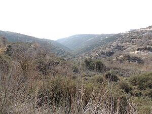
Tsada (also spelled Tsadha) is a village located about 8 kilometers north of Paphos city in Cyprus. Even though it's close to Paphos, Tsada is much higher up, at 612 meters above sea level. This high location gives it a very different feel. It gets about 610 millimeters of rain each year. The weather in Tsada is cooler all year round. In summer, when Paphos is hot and humid, Tsada can be up to 6°C cooler. It's also one of the few places in the Paphos District that gets snow almost every year in late January.
Tsada was the home village of Evagoras Pallikarides, a brave member of the EOKA organization. The village has a history stretching back 500 years. However, most buildings are new, and only a few old homes have been rebuilt in the traditional style. A hill called Melisovouno, located between Tsada and Koili village, has the television and radio antennas for Paphos.
Tsada has a hot-summer Mediterranean climate. This means winters are rainy, and summers are dry. Frost can happen at night in winter, and it sometimes snows. Tsada's climate is perfect for growing grains, various trees, and some nuts. It is also one of the biggest producers of grapes for wine in its area. The village has about 1,000 people. Tsada works with nearby places like Episkopi, Kallepia, and Minthis Hills to attract tourists. They have even created a guide for visitors and hikers exploring the Ezousa valley.
Tsada's Climate
Tsada has a climate known as a hot-summer Mediterranean climate (Csa in the Köppen climate classification system). This means its winter months are much rainier than its summer months. Frost sometimes happens at night almost every winter. Snow also falls in some winters. Winter temperatures can drop to 0°C or even lower.
| Climate data for Tsada, Cyprus (612 m) | |||||||||||||
|---|---|---|---|---|---|---|---|---|---|---|---|---|---|
| Month | Jan | Feb | Mar | Apr | May | Jun | Jul | Aug | Sep | Oct | Nov | Dec | Year |
| Mean daily maximum °C (°F) | 13 (55) |
13.5 (56.3) |
15.4 (59.7) |
19.2 (66.6) |
23.4 (74.1) |
28.0 (82.4) |
30.7 (87.3) |
31.0 (87.8) |
27.9 (82.2) |
24.0 (75.2) |
19.4 (66.9) |
15.1 (59.2) |
21.7 (71.1) |
| Mean daily minimum °C (°F) | 5.6 (42.1) |
5.3 (41.5) |
6.4 (43.5) |
9.0 (48.2) |
12.5 (54.5) |
16.5 (61.7) |
18.6 (65.5) |
19.2 (66.6) |
16.5 (61.7) |
13.5 (56.3) |
10.1 (50.2) |
7.1 (44.8) |
11.7 (53.1) |
| Source: https://en.climate-data.org/asia/cyprus/tsada/tsada-101223 | |||||||||||||
Interesting Places to See
Just outside the village, there is a chapel from the 12th century. It used to be part of a monastery. Today, this chapel, called "Stavros tis Minthis," is right next to an 18-hole golf course. This golf course, named Minthis Hills, was the very first one built in Cyprus. A new resort is also being built there. To the west of Tsada village, you can find the Tsiárta mountain, which is 613 meters tall.
Getting Around Tsada
Tsada is located near an important transport hub. This hub connects most of the villages in the Paphos district. The village is on the main road from Paphos to Polis. It is also on the main route to traditional villages like Kallepia and Choulou. There are daily bus connections to both Paphos and the Polis – Lachi area. The A7 motorway, which will connect Polis to the main road network, will also make Tsada easier to reach. Mouttis tou Naki street is one of the busiest roads in the village.
See also
 In Spanish: Tsada para niños


