
Tull, Arkansas facts for kids
Quick facts for kids
Tull, Arkansas
|
|
|---|---|

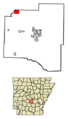
Location of Tull in Grant County, Arkansas.
|
|
| Country | United States |
| State | Arkansas |
| County | Grant |
| Area | |
| • Total | 4.10 sq mi (10.61 km2) |
| • Land | 4.03 sq mi (10.44 km2) |
| • Water | 0.07 sq mi (0.17 km2) |
| Elevation | 351 ft (107 m) |
| Population
(2020)
|
|
| • Total | 484 |
| • Density | 120.04/sq mi (46.35/km2) |
| Time zone | UTC-6 (Central (CST)) |
| • Summer (DST) | UTC-5 (CDT) |
| FIPS code | 05-70220 |
| GNIS feature ID | 2406762 |
Tull is a small town located in Grant County, Arkansas, in the United States. It is a part of the wider Central Arkansas area. In 2020, the town had 484 residents. This was an increase from 448 people counted in 2010, and 358 people in 2000.
Contents
Where is Tull Located?
Tull is found in the northwestern part of Grant County. Its northern and northwestern edges touch the border of Saline County.
Tull's Natural Surroundings
The northwest border of Tull follows the Saline River. This river flows south and eventually joins the Ouachita River.
How Far is Tull from Other Towns?
Tull is about 16 miles (26 km) northwest of Sheridan. Sheridan is the main town and county seat of Grant County. It is also about 10 miles (16 km) south of Benton.
What is Tull's Size?
According to the United States Census Bureau, the town of Tull covers a total area of about 4.10 square miles (10.61 square kilometers). A very small part of this area, about 0.07 square miles (0.17 square kilometers), is water.
Who Lives in Tull?
The number of people living in Tull has grown over the years. Here is a look at the population changes:
| Historical population | |||
|---|---|---|---|
| Census | Pop. | %± | |
| 1970 | 179 | — | |
| 1980 | 281 | 57.0% | |
| 1990 | 313 | 11.4% | |
| 2000 | 358 | 14.4% | |
| 2010 | 448 | 25.1% | |
| 2020 | 484 | 8.0% | |
| U.S. Decennial Census | |||
Tull's Population in 2000
In the year 2000, there were 358 people living in Tull. These people lived in 155 different homes. Most of these homes, 110 of them, were families. The town had about 104 people per square mile (40 people per square kilometer). There were 167 housing units, which are places where people can live.
Diversity in Tull
Most people in Tull in 2000 were White, making up about 99.16% of the population. A small number, 0.56%, were Native American. About 0.28% of the people were from two or more racial backgrounds. Around 3.07% of the population identified as Hispanic or Latino.
How People Live in Tull
Out of the 155 homes in 2000, about 26.5% had children under 18 living there. Most homes, 64.5%, were married couples living together. About 3.9% of homes had a single female head of household without a husband. Around 29.0% of homes were not families. About 27.1% of all homes had only one person living in them. And 20.0% of these single-person homes had someone aged 65 or older.
The average number of people in a home was 2.31. For families, the average size was 2.81 people.
Age Groups in Tull
In 2000, the population of Tull was spread out by age.
- 19.0% were under 18 years old.
- 7.8% were between 18 and 24 years old.
- 27.9% were between 25 and 44 years old.
- 29.1% were between 45 and 64 years old.
- 16.2% were 65 years old or older.
The average age of a person in Tull was 43 years. For every 100 females, there were about 101 males. For every 100 females aged 18 and over, there were about 93 males.
Income in Tull
In 2000, the average income for a household in Tull was $33,750 per year. For families, the average income was $41,406 per year. Males generally earned more, with an average income of $30,417, compared to $29,250 for females. The average income per person in the town was $18,017. About 10.1% of families and 10.7% of all people in Tull lived below the poverty line. This included 14.1% of those under 18 and 7.8% of those aged 65 or older.
Learning in Tull
Students living in Tull attend schools that are part of the Bauxite School District. This means that students from Tull are expected to go to Bauxite High School for their high school education.
Images for kids
-
Location of Tull in Grant County, Arkansas.
See also
 In Spanish: Tull (Arkansas) para niños
