Grant County, Arkansas facts for kids
Quick facts for kids
Grant County
|
|
|---|---|

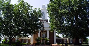
Grant County Courthouse in Sheridan
|
|

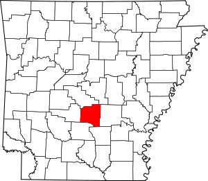
Location within the U.S. state of Arkansas
|
|
 Arkansas's location within the U.S. |
|
| Country | |
| State | |
| Founded | February 4, 1869 |
| Named for | Ulysses S. Grant |
| Seat | Sheridan |
| Largest city | Sheridan |
| Area | |
| • Total | 633 sq mi (1,640 km2) |
| • Land | 632 sq mi (1,640 km2) |
| • Water | 1.1 sq mi (3 km2) 0.2%% |
| Population
(2020)
|
|
| • Total | 17,958 |
| • Estimate
(2023)
|
18,383 |
| • Density | 28.370/sq mi (10.954/km2) |
| Time zone | UTC−6 (Central) |
| • Summer (DST) | UTC−5 (CDT) |
| Congressional district | 4th |
Grant County is a county located in the state of Arkansas, USA. It is a place where many people live and work. In 2020, about 17,958 people called Grant County home. The main town and center of the county is Sheridan. Grant County is also part of a larger area that includes the cities of Little Rock and North Little Rock.
Contents
Discovering Grant County's Past
Grant County was officially created on February 4, 1869. It was named to honor Ulysses S. Grant, who was about to become the U.S. President.
Some important people from Grant County's history include Robert W. Glover. He was a pastor and also served in the state government of Arkansas from 1905 to 1912. In 1909, he helped create a plan for new agricultural colleges in the state.
His brother, David Delano Glover, also served in the state government. Later, he became a member of the United States House of Representatives from 1929 to 1935. Another famous person from Grant County was John Little McClellan. He became Arkansas's longest-serving U.S. senator.
Exploring Grant County's Geography
Grant County covers a total area of about 633 square miles. Most of this area, about 632 square miles, is land. The rest is water, making up a small part of the county. Grant County is known for its forests and is part of the Arkansas Timberlands region.
Main Roads in Grant County
These are some of the important roads that help people travel through Grant County:
 U.S. Highway 167
 U.S. Highway 270
 Highway 35
 Highway 46
Neighboring Counties
Grant County shares its borders with several other counties. These are like its neighbors:
- Saline County (to the north)
- Pulaski County (to the northeast)
- Jefferson County (to the east)
- Cleveland County (to the southeast)
- Dallas County (to the south)
- Hot Spring County (to the west)
People of Grant County
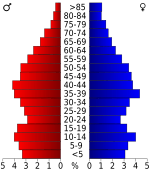
In 2020, the census counted 17,958 people living in Grant County. Most of the people living here are White. There are also communities of Black or African American, Native American, and Asian people. Many people in Grant County identify with more than one race. About 2.45% of the population is of Hispanic or Latino background.
The census also showed that there were 6,863 households and 5,007 families living in the county.
Communities in Grant County
Grant County has several towns and cities where people live.
Cities in Grant County
- Leola
- Prattsville
- Sheridan (This is the county seat, meaning it's the main administrative center.)
Towns in Grant County
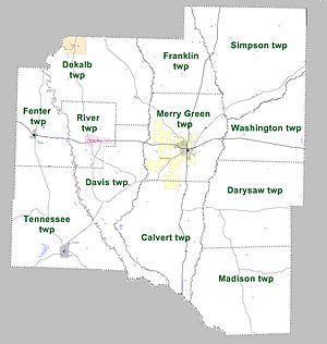
Townships in Grant County
Counties in Arkansas are divided into smaller areas called townships. Here are the townships in Grant County:
Culture and Fun in Grant County
Grant County is home to Jenkins' Ferry Battleground State Park. This park is a historical site where an important battle took place during the American Civil War. It's a great place to learn about history and enjoy nature.
See also
 In Spanish: Condado de Grant (Arkansas) para niños
 | Stephanie Wilson |
 | Charles Bolden |
 | Ronald McNair |
 | Frederick D. Gregory |


