
Turanganui River (Gisborne) facts for kids
Quick facts for kids Turanganui River |
|
|---|---|

This photo from Kaiti Hill shows more than half of the Turanganui River. The meeting point of the Taruheru and Waimata rivers can be seen on the right, upstream from the road bridge.
|
|
| Country | New Zealand |
| Physical characteristics | |
| Main source | meeting point of Taruheru River and Waimata River |
| River mouth | Poverty Bay 0 m (0 ft) |
| Length | 1.2 km (0.75 mi) |
The Turanganui River is a short but important river located in the city of Gisborne, New Zealand. It starts where two other rivers, the Taruheru River and the Waimata River, meet. From there, it flows right through the center of Gisborne before reaching the Pacific Ocean at the top end of Poverty Bay.
Close to where the river meets the sea, there is a special memorial. This marks the first place in New Zealand where Captain James Cook landed. A cool fact about the Turanganui River is that its entire length is affected by the tides, meaning the water level goes up and down with the ocean. Some people even say it's the shortest river in the entire Southern Hemisphere!
Contents
All About the Turanganui River
The Turanganui River is a key feature of Gisborne. It's not very long, only about 1.2 kilometers (0.75 miles) from where it begins to where it flows into the sea. Even though it's short, it plays a big role in the city.
What Does the Name Mean?
The name Turanganui comes from the Māori language. The New Zealand Ministry for Culture and Heritage explains that it means "great standing place." This name likely refers to its importance as a place for people to gather or land.
River Flow and the Harbour
The Turanganui River flows into the Gisborne Harbour. A strong concrete wall, called a breakwater, helps separate the main river channel from the harbor area. This helps keep the harbor calm and safe for boats.
Water Quality in the River
The water quality in the Turanganui River can sometimes be a bit poor. This is because it collects water from two very large areas where people use the land for different things, like farming or city activities. However, because the river is tidal, the ocean water helps to mix and improve the water quality regularly.
Images for kids
-
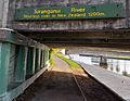
A sign on the Turanganui road bridge.

