Turnbull Canyon facts for kids
Quick facts for kids Turnbull Canyon |
|
|---|---|

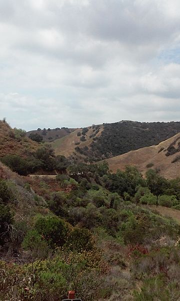
Turnbull Canyon from Skyline Dr.
|
|
| Highest point | |
| Peak | Skyline Drive |
| Elevation | 242 m (794 ft) |
| Geography | |
| Country | United States |
| State | California |
| District | Los Angeles County |
| Topo map | USGS Whittier, California |
Turnbull Canyon is a cool place to explore near Whittier, California. It's a 4-mile loop trail that's part of the Puente Hills Preserve. This canyon runs from east to west and has a creek at the bottom. Along the creek, you'll find sycamore trees. The hillsides are covered with coastal sage plants and different kinds of grasses.
Contents
Weather in Turnbull Canyon
The weather in Turnbull Canyon is like much of Southern California. It's often dry, which is called "semi-arid." Because the Whittier Hills are close to the ocean, the temperature stays pretty steady. It's usually a bit cooler here than in some areas further south. In winter, you might see frost on the ground. In summer, it rarely gets hotter than 95 degrees Fahrenheit (35 degrees Celsius).
Who Visits Turnbull Canyon?
Many people enjoy visiting Turnbull Canyon! It's a popular spot for outdoor activities. About 73 people visit the canyon each day. Half of these visitors, around 50%, are hikers or runners. A good number, about 41%, come to ride their bikes. You'll also see people bringing their dogs along, making up about 9% of visitors. Most visitors are male (around 78%), while about 22% are female.
Things to See and Do
Turnbull Canyon is known for its amazing views. From certain spots, you can see the beautiful Hsi Lai Temple and the large Rose Hills Memorial Park. The canyon is also a place where some local stories and legends are told.
Images for kids
 | Kyle Baker |
 | Joseph Yoakum |
 | Laura Wheeler Waring |
 | Henry Ossawa Tanner |


