Whittier, California facts for kids
Quick facts for kids
Whittier, California
|
|||
|---|---|---|---|
|
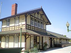
Skyline of Whittier, California
|
|||
|
|||
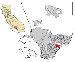
Location of Whittier in Los Angeles County, California
|
|||
| Country | United States | ||
| State | California | ||
| County | Los Angeles | ||
| Incorporated | February 25, 1898 | ||
| Government | |||
| • Type | Council-Manager | ||
| Area | |||
| • Total | 14.66 sq mi (37.98 km2) | ||
| • Land | 14.65 sq mi (37.94 km2) | ||
| • Water | 0.02 sq mi (0.04 km2) 0.11% | ||
| Elevation | 367 ft (112 m) | ||
| Population
(2020)
|
|||
| • Total | 87,306 | ||
| • Rank | 98th in California | ||
| • Density | 5,824.9/sq mi (2,249.0/km2) | ||
| Demonym(s) | Whittierite | ||
| Time zone | UTC−8 (Pacific) | ||
| • Summer (DST) | UTC−7 (PDT) | ||
| ZIP Codes |
90601–90610
|
||
| Area code | 562 | ||
| FIPS code | 06-85292 | ||
| GNIS feature IDs | 1652813, 2412260 | ||
Whittier is a city in Southern California, located in Los Angeles County. It is part of the area known as the Gateway Cities. In 2020, about 87,306 people lived here.
Whittier became an official city in February 1898. Later, in 1955, it became a charter city, which means it has its own local rules for how it is run. The city is named after John Greenleaf Whittier, a famous Quaker poet. It is also home to Whittier College.
Contents
- What's in a Name? The Story of Whittier
- Whittier's Past: A Look at History
- Whittier's Location and Climate
- Who Lives in Whittier? Demographics
- Whittier's Economy and Jobs
- Arts, Culture, and Fun in Whittier
- Education in Whittier
- Media and News in Whittier
- Getting Around Whittier: Transportation
- Famous People from Whittier
- Whittier on Screen: Film and TV Locations
- Sister Cities
- See also
What's in a Name? The Story of Whittier
Whittier got its name from a respected Quaker poet named John Greenleaf Whittier. When the town was first settled, early residents like Jonathan and Rebecca Bailey were Quakers. They held religious meetings on their porch.
As the town grew, people decided to name it after John Greenleaf Whittier. They even gave him a piece of land. He wrote a special poem for the city. Today, you can see statues of him in Whittier's Central Park and near the main library. Even though he never visited, his name and the Quaker tradition live on in the city.
Whittier's Past: A Look at History

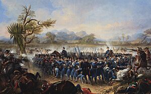
The Gabrielino people were the first to live in this area.
Whittier's history began with a Spanish soldier named Manuel Nieto. In 1784, he received a huge land grant of about 300,000 acres (1,200 km²) from Spain. This land was called Rancho Los Nietos. It was a reward for his military service.
Nieto's land was later made smaller. But he still owned a large area. This land stretched from the hills north of Whittier down to the Pacific Ocean. He built a ranch, raised animals, and grew crops.
In the 1840s, much of the land that became Whittier was owned by Pio Pico. He was a rancher and the last Mexican governor of California. Pio Pico built a large home, or hacienda, which is now Pio Pico State Historic Park.
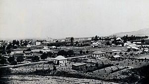
After the Mexican-American War, a German immigrant named Jacob F. Gerkens bought 160 acres (0.65 km²) of land. He built a cabin, which is now known as the Jonathan Bailey House. Later, a group of Quakers bought this land and expanded it to 1,259 acres (5.10 km²). They wanted to create a Quaker community.
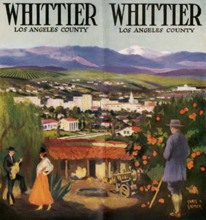
The area became known for its citrus farms. "Quaker Brand" fruit was sent all over the United States. Later, walnut trees were planted. Whittier became the biggest walnut grower in the country. They also grew a lot of pampas grass.
For many years, it was hard to travel from Whittier to Los Angeles. The roads were rough dirt paths. In 1887, business people paid to build the first railroad line to Whittier. This made it easier to transport goods. By 1906, many train cars of oranges and lemons were shipped each year. In 1904, the Pacific Electric trolley line, called "Big Red Cars," opened. Over a million passengers rode the trolley each year.
After World War II, Whittier grew very quickly. Orange groves were divided into lots for new homes. In 1955, the Civic Center was finished. The city continued to grow by adding nearby areas. By 1961, the population reached about 67,000 people.
Quaker Community in Whittier
The first Quaker meetings in Whittier were held on the porch of the Jonathan Bailey House. As more Quakers moved to the area, they needed a bigger place to meet. The first Quaker meeting house was built in 1887.
The community grew, and larger meeting houses were built in 1902 and 1917. The 1917 building could hold 1,700 people. It had beautiful stained glass windows. The current meeting house, built in 1975, still uses many parts from the old 1917 building. Quakers also started Whittier Academy, which later became Whittier College.
Whittier's Colleges and Schools
In 1887, land was set aside for a college. But building was delayed. On July 30, 1896, Whittier Academy officially became Whittier College. It started with 100 students. The school's mascot is "The Poet." By 1906, Whittier College had laboratories, dorms, a gym, and sports fields.
The Mendenhall Building at Whittier College was donated by Leona May Mendenhall. Her family, the Mendenhalls, were important in Whittier's early days. They helped bring in the water system and post office. They were also big growers of Sunkist oranges and Blue Diamond walnuts.
Whittier was also the first home of Azusa Pacific University. It was started in 1899 by Quakers and a Methodist evangelist.
The 1987 Whittier Narrows Earthquake
On October 1, 1987, a strong earthquake hit Whittier. It was called the 1987 Whittier Narrows earthquake. The earthquake measured 5.9 on the moment magnitude scale. It caused damage to many historic buildings in Uptown Whittier. Three days later, a large aftershock caused even more damage.
After the earthquake, many old buildings were torn down. This led to the creation of the Whittier Conservancy in 1987. This group works to protect historic buildings. The city also created a Historic Resources Commission. This group helps decide which buildings are important to save.
Whittier's Location and Climate
Whittier covers about 14.7 square miles (38.0 km²). Most of this area is land.
Whittier is surrounded by other cities and communities. To the northeast is Hacienda Heights. To the north is the City of Industry. Pico Rivera is to the west. La Habra Heights is to the east. La Habra is to the southeast, and Santa Fe Springs is to the south.
Whittier's Neighborhoods
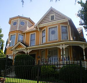
Whittier has several distinct neighborhoods. The area around Philadelphia Street and Greenleaf Avenue is known as Uptown Whittier. This is the traditional downtown area. North of Uptown are the Central Park and Hadley-Greenleaf neighborhoods. These areas have many beautiful Craftsman and Spanish Colonial Revival style homes.
North of these historic districts is Starlite Estates. The area around Whittier College is called College Hills. It also has historic homes. East of College Avenue is East Whittier, which used to be farmland. The eastern part of East Whittier, developed in the 1950s and 1960s, is called Friendly Hills.
Whittier's Weather
Whittier is about 15 miles (24 km) from the Pacific Ocean. This means it has warmer daytime temperatures than coastal cities. In winter, daytime temperatures are usually between 57°F and 72°F (14°C and 22°C). Nights drop to about 41°F to 50°F (5°C to 10°C).
In summer, highs range from 84°F to 97°F (29°C to 36°C). Overnight lows are around 62°F to 70°F (17°C to 21°C). Most of the rain falls in winter, and summers are usually dry. The city gets about 14 inches (356 mm) of rain each year.
Who Lives in Whittier? Demographics
| Historical population | |||
|---|---|---|---|
| Census | Pop. | %± | |
| 1890 | 585 | — | |
| 1900 | 1,590 | 171.8% | |
| 1910 | 4,550 | 186.2% | |
| 1920 | 7,997 | 75.8% | |
| 1930 | 14,822 | 85.3% | |
| 1940 | 16,115 | 8.7% | |
| 1950 | 23,433 | 45.4% | |
| 1960 | 33,663 | 43.7% | |
| 1970 | 72,863 | 116.4% | |
| 1980 | 68,558 | −5.9% | |
| 1990 | 77,671 | 13.3% | |
| 2000 | 83,680 | 7.7% | |
| 2010 | 85,331 | 2.0% | |
| 2020 | 87,306 | 2.3% | |
| U.S. Decennial Census | |||
In 2020, Whittier had a population of 87,306 people. This means there were about 5,825 people per square mile. The population included people from many different backgrounds. About 65.8% of the population was Hispanic or Latino.
The average household size was about three people. The median household income was around $76,026. About 9.5% of the population lived in poverty.
About 23% of the population was under 18 years old. About 15% was over 65 years old. Most adults (88.5%) had finished high school. About 26.7% had a college degree or higher.
| Race / Ethnicity (NH = Non-Hispanic) | Pop 2000 | Pop 2010 | Pop 2020 | % 2000 | % 2010 | % 2020 |
|---|---|---|---|---|---|---|
| White alone (NH) | 31,475 | 24,126 | 18,018 | 37.61% | 28.27% | 20.64% |
| Black or African American alone (NH) | 838 | 780 | 1,014 | 1.00% | 0.91% | 1.16% |
| Native American or Alaska Native alone (NH) | 341 | 226 | 248 | 0.41% | 0.26% | 0.28% |
| Asian alone (NH) | 2,628 | 2,996 | 3,967 | 3.14% | 3.51% | 4.54% |
| Pacific Islander alone (NH) | 90 | 91 | 122 | 0.11% | 0.11% | 0.14% |
| Other race alone (NH) | 113 | 131 | 440 | 0.14% | 0.15% | 0.50% |
| Mixed race or Multiracial (NH) | 1,430 | 900 | 1,694 | 1.71% | 1.05% | 1.94% |
| Hispanic or Latino (any race) | 46,765 | 56,081 | 61,803 | 55.89% | 65.72% | 70.79% |
| Total | 83,680 | 85,331 | 87,306 | 100.00% | 100.00% | 100.00% |
Whittier's Economy and Jobs
Whittier is working to improve its community with new projects. One project is near the Hoover Hotel. Another is a large development near Whittier Boulevard. In 2019, Whittier opened its first food hall, Poet Gardens, in Uptown Whittier.
The Whittwood Town Center is a popular shopping area in Whittier.
Major Employers in Whittier
Here are some of the biggest employers in Whittier:
| # | Employer | # of Employees |
|---|---|---|
| 1 | Presbyterian Intercommunity Hospital | 2,600 |
| 2 | Whittier Union High School District | 950 |
| 3 | Whittier Hospital Medical Center | 850 |
| 4 | Whittier City School District | 720 |
| 5 | City of Whittier | 621 |
| 6 | United States Postal Service | 360 |
| 7 | Bright Health Physicians | 300 |
| 8 | Ralph's | 270 |
| 9 | Los Angeles County |
Arts, Culture, and Fun in Whittier
On April 17, 1900, the Whittier Public Library opened its first meeting. It started with 60 books and 200 magazines. In 1907, a grant helped build a new library building. As the city grew, a larger library was needed. The Friends of the Library group helped raise money for a new building, which opened in 1959. In 1968, a branch library was built called the Whittwood Branch Library.
Historic Places and Entertainment
- Rose Hills Memorial Park is a very large cemetery located near Whittier.
- Whittier is home to several California Historical Landmarks:
- Pio Pico State Historic Park: This is the home of Pío Pico, the last Mexican Governor of California.
- Grave of George Caralambo: His grave marker is at the Whittier Museum.
- Paradox Hybrid Walnut Tree: A special walnut tree.
- Reform School for Juvenile Offenders: This was the Fred C. Nelles Youth Correctional Facility, which closed in 2004. It is now being redeveloped.
- The Whittier Museum is open for public tours on Fridays and Saturdays. It is free to visit.
- Whittier also has places listed on the National Register of Historic Places:
- Pio Pico House
- Hoover Hotel
- Southern Pacific Railroad Depot
- Standard Oil Building
- Jonathan Bailey House
- National Bank of Whittier Building
- Orin Jordan House
Education in Whittier
Several school districts serve the city of Whittier. These include the Whittier Union High School District and the Whittier City School District.
There are five high schools in the Whittier Union High School District: California High School, La Serna High School, Pioneer High School, Santa Fe High School, and Whittier High School. There is also Frontier High School for alternative education. Adults can attend the Whittier Adult School.
Whittier also has three private Catholic elementary schools: St. Bruno's Parish School, St Gregory The Great Parish School, and St. Mary of the Assumption School. These schools are run by the Roman Catholic Archdiocese of Los Angeles.
Whittier Friends School is a Quaker school with a preschool and elementary school (up to 6th grade). Trinity Lutheran School serves kindergarten through eighth grade. Whittier Christian School and Plymouth Christian School also offer private education.
For higher education, students can attend Rio Hondo College, Southern California University of Health Sciences, and Whittier College.
Media and News in Whittier
The local newspaper for Whittier is the Whittier Daily News. Other newspapers that cover the area include the San Gabriel Valley Tribune and the Los Angeles Times. The music magazine Flipside was published in Whittier from 1977 to 1990.
Getting Around Whittier: Transportation
Whittier has many bus routes. Metro, Foothill Transit, Montebello Bus Lines, and the Norwalk Transit are the main bus services. These buses connect Whittier to other cities and train stations.
Whittier also has several important roads. The San Gabriel River Freeway (I-605) runs along the northern part of the city. State Route 72 goes through Whittier via Whittier Boulevard. Other major streets include Beverly Boulevard, Colima Road, and Greenleaf Avenue.
Police and Fire Services
The Whittier Police Department provides law enforcement services for the city.
The Los Angeles County Fire Department has three fire stations in Whittier. These stations help keep the community safe.
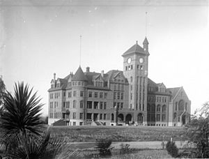
Fred C. Nelles Youth Correctional Facility
The Fred C. Nelles Youth Correctional Facility was a state reform school. It opened in 1891, even before Whittier became a city. It was California's longest-running state school for young offenders. It closed in 2004.
After it closed, the facility was used for filming movies and TV shows. In 2014, plans were announced to build new homes and businesses on the site. This 74-acre (0.30 km²) area offers a unique chance for growth in Whittier. Some historic buildings, like the administration building, are being saved. New housing and commercial spaces are now being built there.
Famous People from Whittier
Many well-known people have connections to Whittier:
- George Allen, a former governor and U.S. Senator.
- Shirley Babashoff, a swimmer who won eight Olympic medals.
- Andrea Barber, an actress known for Full House.
- Nomar Garciaparra, a professional baseball player.
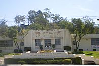
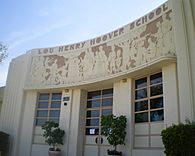
- Lou Henry Hoover, the wife of U.S. President Herbert Hoover.
- Gabriel Iglesias, a famous comedian.
- John Lasseter, who helped start Pixar Animation Studios.
- Richard Nixon, the 37th President of the United States. He grew up in East Whittier and went to Whittier High School and Whittier College.
- Pat Nixon, the First Lady of the United States and wife of Richard Nixon.
- Tom Waits, a musician and actor.
- Jessamyn West, an author.
Whittier on Screen: Film and TV Locations
Whittier has been a filming location for many movies and TV shows:
- Masters of the Universe (1987)
- Back to the Future (1985) and Back to the Future Part II (1989): Whittier High School was used as Hill Valley High School.
- Hocus Pocus (1993): Parts were filmed in Uptown Whittier.
- Father of the Bride Part II (1995)
- The Wonder Years (1988–1993): The parade scene in the last episode was filmed in Uptown Whittier.
- Bringing Down the House (2003): Filmed at the Friendly Hills Country Club.
- Terminator 3: Rise of the Machines (2003): Parts were shot in Whittier.
- Blow (2001): Scenes were filmed at the Fred C. Nelles Youth Correctional Facility.
- Disturbia (2007): Filmed on Painter Ave and in Uptown Whittier.
- The Muppets (2011): Scenes for Walter and Gary's hometown were shot in a historic Uptown Whittier neighborhood.
- The Little Things (2021): Scenes were shot in Uptown Whittier.
Sister Cities
See also
 In Spanish: Whittier (California) para niños
 | Selma Burke |
 | Pauline Powell Burns |
 | Frederick J. Brown |
 | Robert Blackburn |


