Turrialba Volcano facts for kids
Quick facts for kids Turrialba Volcano |
|
|---|---|

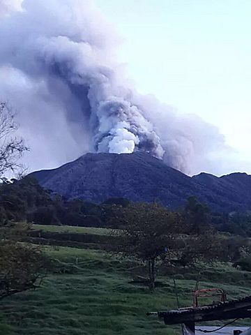
Turrialba volcano while in eruption, October 2014
|
|
| Highest point | |
| Elevation | 3,340 metres (10,958 ft) |
| Geography | |
| Parent range | Cordillera Central |
| Geology | |
| Age of rock | 1.5 million years |
| Mountain type | Stratovolcano |
| Last eruption | 2022 |
| Climbing | |
| Easiest route | hike |
Turrialba Volcano is an active volcano located in the center of Costa Rica. It has erupted many times in recent years, including in 2016 and in early 2017. Before these eruptions, people could hike right into its main crater.
However, because of the increased volcanic activity from 2014 to 2017, which sent out large clouds of volcanic ash, the nearby Turrialba Volcano National Park had to close. Good news! The eruptions calmed down, and the park, along with the volcano, reopened on December 4, 2020.
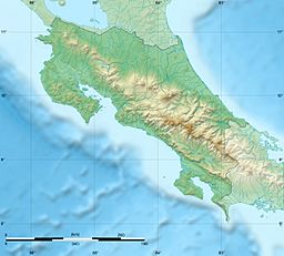
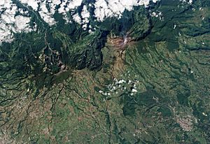
This type of volcano is called a stratovolcano. It stands 3,340 m (10,958 ft) tall. The volcano is about 45 minutes away from the town of Turrialba, which is on the Atlantic side of Costa Rica. The top of the volcano has three craters. The biggest one is about 50 m (160 ft) wide.
Turrialba is right next to Irazú, and both are among the largest volcanoes in Costa Rica. Turrialba has had at least five big explosive eruptions in the last 3,500 years. Scientists keep a close eye on the volcano using a project called the Deep Earth Carbon Degassing Project.
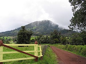
On clear days, you can see both the Pacific Ocean and the Caribbean Sea from the top of Turrialba. Below the summit, there's a mountain range and a montane forest. This forest is home to plants like ferns, bromeliads, lichens, and mosses. Most of this forest is either original (primary) or has grown back (secondary).
The volcano gets its name from its local area, called a canton, which is also named Turrialba. This canton is in Costa Rica's Cartago Province. No one is completely sure where the name Turrialba came from. Some historians think it might come from a Spanish family name or from the Latin words "Turris alba" (meaning "white tower"). However, most people agree that the name Turrialba comes from the local Huetar language of the native people, even if the exact meaning is still a mystery.
Contents
Volcano Activity
Turrialba Volcano has a long history of activity. Here are some of its notable events:
- During the 1800s, the volcano erupted and released ash many times. This happened in 1847, 1853, 1855, 1859, and 1866. These eruptions also produced fast-moving flows of hot gas and rock called pyroclastic flows. The last major eruption during this period was in 1866.
- Small signs of activity began again in 1996.
- In January 2001, the volcano showed more activity. It had strong fumarole activity, which means hot gases were coming out of cracks in the central craters. Volcanic activity has generally increased since 2005.
- The National Park area was closed to visitors from 2009 to 2011 because of the increased activity.
- On January 8, 2010, a phreatic eruption happened. This is an eruption caused by steam, not magma. It created a new opening near the crater on the southwest side. The temperature of the gases also rose a lot, from 200 to 600 °C (392 to 1,112 °F). Two nearby villages had to be evacuated for safety.
- In January 2012, another phreatic eruption created a new opening on the west side of the crater.
- A small eruption took place on April 12, 2012.
- On May 21, 2013, a gas explosion made several openings near the main crater wider. These openings had first appeared in 2010 and 2012.
- In July 2013, scientists noticed that small earthquakes around the volcano increased. They went from about 20 earthquakes a day to as many as 30 per hour.
- On October 17, 2014, the number of tremors increased even more, from about 50-100 a day to 200 a day.
- On October 29, 2014, a tremor started and continued until a phreatic eruption occurred around 11:10 PM. This eruption happened at the west opening that appeared in January 2012. It sent a large amount of volcanic material up to 40 km (25 mi) away. Many people reported ash falling on their homes and a strong smell of sulfur in many towns across the provinces of San José, Cartago, and Heredia.
March 2015 Eruptions
- On March 12, 2015, eruptions around 11:00 AM and 2:12 PM sent ash across the entire Central Valley of Costa Rica. This was considered the most significant activity since 1996.
- The Juan Santamaría and Tobías Bolaños international airports had to close because the ash made it too hard to see (visibility was less than 100 meters).
- Another eruption happened on March 13, 2015, at 9:07 PM.
May 2015 Eruption
- On May 4, 2015, an eruption occurred at 3:24 PM.
May 2016 Eruption
An eruption took place on May 21, 2016. One person living nearby described it as the biggest eruption since 2010. Ash fell as far away as the capital city, San Jose. At least 500 people went to hospitals because they had trouble breathing. Flights into San Jose were canceled due to worries about the ash.
September 2016 Eruptions
On September 19, 2016, at 2:54 AM, an eruption lasted about 15 minutes. This was the first of many eruptions that day, which eventually covered the metropolitan area with ash. More eruptions happened at 11:30 AM, 2:40 PM, and 3:34 PM.
The eruptions continued into September 20, with another one at 6:20 AM. Airports in the metropolitan area were closed because of the ash.
See also
 In Spanish: Volcán Turrialba para niños
- List of volcanoes in Costa Rica
 | Bayard Rustin |
 | Jeannette Carter |
 | Jeremiah A. Brown |


