University Heights, Iowa facts for kids
Quick facts for kids
University Heights, Iowa
|
||
|---|---|---|

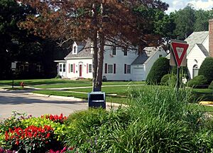
Melrose Triangle
|
||
|
||
| Motto(s):
The Height of Good Living
|
||

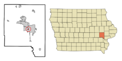
Location of University Heights, Iowa
|
||
| Country | ||
| State | ||
| County | Johnson | |
| Incorporated | 1935 | |
| Government | ||
| • Type | Mayor-council government | |
| Area | ||
| • Total | 0.23 sq mi (0.60 km2) | |
| • Land | 0.23 sq mi (0.60 km2) | |
| • Water | 0.00 sq mi (0.00 km2) | |
| Elevation | 764 ft (233 m) | |
| Population
(2020)
|
||
| • Total | 1,228 | |
| • Density | 5,339.13/sq mi (2,046.67/km2) | |
| Time zone | UTC-6 (Central (CST)) | |
| • Summer (DST) | UTC-5 (CDT) | |
| ZIP code |
52246
|
|
| Area code(s) | 319 | |
| FIPS code | 19-79770 | |
| GNIS feature ID | 0462482 | |
University Heights is a small city in Johnson County, Iowa, United States. It is part of the larger Iowa City area. In 2020, about 1,228 people lived there.
This city is special because it is completely surrounded by Iowa City. It is also very close to the University of Iowa campus and Kinnick Stadium. Some people think University Heights is a place where drivers might get speeding tickets often.
Contents
History of University Heights
At the start of the 1900s, the area that is now University Heights was mostly farmland. It was known as West Lucas Township. Back then, the University of Iowa and Iowa City had not yet grown much to the west of the Iowa River.
Early Development and Growth
In the early 1920s, two brothers, Lee and George Koser, started buying land in this area. They believed the University and Iowa City would soon expand westward. They were right! The University built its General Hospital in 1928 and Kinnick Stadium in 1929.
By 1933, Iowa City began adding land on the west side of the river. Then, in 1935, University Heights officially became its own city. By the 1960s, most of the land in University Heights was built on. The areas around it were taken over by Iowa City, which meant University Heights could not grow much more.
Past Property Rules
When University Heights was first set up, many property deeds had rules about who could live there. These rules said that only people of the "Caucasian Race" could own or use the land. The only exception was for servants or helpers of other races. These rules were legally allowed until 1948. That year, the U.S. Supreme Court made a decision in the case of Shelley v. Kraemer that made such rules unenforceable.
Geography and Location
University Heights is located at coordinates 41.653666 degrees north and -91.558167 degrees west.
The United States Census Bureau says the city covers about 0.27 square miles (0.70 square kilometers). All of this area is land.
Population and People
| Historical Populations | ||
|---|---|---|
| Year | Pop. | ±% |
| 1940 | 261 | — |
| 1950 | 446 | +70.9% |
| 1960 | 841 | +88.6% |
| 1970 | 1,265 | +50.4% |
| 1980 | 1,069 | −15.5% |
| 1990 | 1,042 | −2.5% |
| 2000 | 987 | −5.3% |
| 2010 | 1,051 | +6.5% |
| 2020 | 1,228 | +16.8% |
| Source: and Iowa Data Center Source: |
||
How Many People Live Here?
In 2010, there were 1,051 people living in University Heights. They lived in 474 households, and 251 of these were families. The city had about 3,893 people per square mile. There were 512 homes in total.
Most of the people living there (93.5%) were White. About 1.0% were African American, and 3.3% were Asian. A small number were from other racial backgrounds. About 2.8% of the population was Hispanic or Latino.
Households and Families
About 21.9% of households had children under 18. Nearly 45% of households were married couples. Some households had a single female or male parent. About 47% of households were not families.
About 31.2% of all households were people living alone. About 5.2% of households had someone aged 65 or older living by themselves. The average household had 2.22 people. The average family had 2.78 people.
The average age of people in the city was 30.5 years. About 17.1% of residents were under 18. About 17.8% were between 18 and 24. Most people, 32.3%, were between 25 and 44. About 21.5% were between 45 and 64. And 11.3% were 65 or older. The population was almost evenly split between males (50.6%) and females (49.4%).
Education in University Heights
University Heights has one school within its borders: Horn Elementary School. This school is part of the Iowa City Community School District.
Students from University Heights go to Northwest Junior High School for middle school. For high school, they attend West High School. A small part of the University of Iowa's Finkbine Golf Course is also located in the northwest area of University Heights.
Parks and Outdoor Spaces
University Heights owns two wooded areas at its very north end. One is 11.8 acres and the other is 0.7 acres. However, the city does not have any official parks that it operates.
There is a sidewalk along the north side of Melrose Avenue, which is good for walking.
City Government and Elections
Special Election in 2009
In 2009, a developer named Jeff Maxwell wanted to build a large project. It was planned for the land where St. Andrew Presbyterian Church was located. The city's zoning commission did not approve this plan. Then, the city council also voted against it.
This development plan caused a lot of interest in the city election that year. Ten people ran for city council, and many more people voted than usual. Four of the five council members who were elected supported the Maxwell development.
One of these council members, Amy Moore, later resigned. Jim Lane was appointed to take her place. However, some residents gathered enough signatures to ask for a special election. The two candidates in this election, held on January 11th, were Jim Lane and Rosanne Hopson. Rosanne Hopson had lived in the city for a long time.
A record 495 people voted in this special election. Hopson won with 262 votes (53%), and Lane received 233 votes (47%).
See also
 In Spanish: University Heights (Iowa) para niños
 | Ernest Everett Just |
 | Mary Jackson |
 | Emmett Chappelle |
 | Marie Maynard Daly |


