Upper Uwchlan Township, Pennsylvania facts for kids
Quick facts for kids
Upper Uwchlan Township
|
|
|---|---|
|
Township
|
|
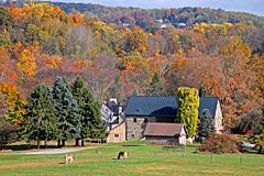
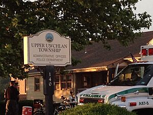
Upper Uwchlan Township in October 2015
|
|
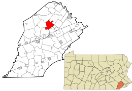
Location of Upper Uwchlan Township in Chester County, Pennsylvania (top) and of Chester County in Pennsylvania (below)
|
|
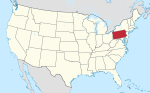
Location of Pennsylvania in the United States
|
|
| Country | United States |
| State | Pennsylvania |
| County | Chester |
| Area | |
| • Total | 11.72 sq mi (30.36 km2) |
| • Land | 10.89 sq mi (28.21 km2) |
| • Water | 0.83 sq mi (2.15 km2) |
| Elevation | 469 ft (143 m) |
| Population
(2010)
|
|
| • Total | 11,227 |
| • Estimate
(2016)
|
11,500 |
| • Density | 1,055.72/sq mi (407.60/km2) |
| Time zone | UTC-5 (EST) |
| • Summer (DST) | UTC-4 (EDT) |
| ZIP Code |
19480
|
| Area code(s) | 484, 610, 835 |
| FIPS code | 42-029-79352 |
Upper Uwchlan Township is a place in Chester County, Pennsylvania, United States. It is a type of local government area called a township. In 2010, about 11,227 people lived there.
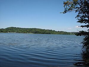
A community called Milford Mills used to be part of the township. However, it was covered by water when the Marsh Creek Dam was built in 1972.
The main part of the township has grown around the old Eagle Tavern. This tavern is at the crossing of Route 100 and Little Conestoga Road. This area is known as the village of Eagle. It is also sometimes called Uwchlan. The local post office is located there.
Contents
History of Upper Uwchlan
Several important historical places in Upper Uwchlan Township are recognized nationally. These include the Byers Station Historic District and the West Vincent Highlands Historic District. Also listed are the Larkin Covered Bridge and the Wheelen House. These places are on the National Register of Historic Places. This list helps protect buildings and areas that are important to American history.
Geography and Nature
Upper Uwchlan Township covers about 11.6 square miles (30.36 square kilometers). Most of this area is land, about 10.8 square miles (28.21 square kilometers). The rest, about 0.9 square miles (2.15 square kilometers), is water. This water makes up about 7.33% of the township's total area.
Population and People
| Historical population | |||
|---|---|---|---|
| Census | Pop. | %± | |
| 1930 | 597 | — | |
| 1940 | 689 | 15.4% | |
| 1950 | 761 | 10.4% | |
| 1960 | 909 | 19.4% | |
| 1970 | 996 | 9.6% | |
| 1980 | 1,805 | 81.2% | |
| 1990 | 4,396 | 143.5% | |
| 2000 | 6,850 | 55.8% | |
| 2010 | 11,227 | 63.9% | |
| 2020 | 12,275 | 9.3% | |
The number of people living in Upper Uwchlan Township has grown a lot over the years. In 2010, the population was 11,227. By 2020, it had increased to 12,275.
In 2010, most people living in the township were non-Hispanic White (80.8%). About 14.1% were Asian, and 1.4% were Black or African American. About 1.3% of people were of two or more races. Also, 2.4% of the population had Hispanic or Latino family backgrounds.
Schools and Education
Upper Uwchlan Township is part of the Downingtown Area School District. This district manages the public schools in the area.
Children in the township attend different elementary schools. These include Brandywine-Wallace, Pickering Valley, Shamona Creek, and Springton Manor. For middle and high school, the township is split into two areas. Students go to either Downingtown Middle School and Downingtown West High School, or Lionville Middle School and Downingtown East High School.
There are also private schools in the township. St. Elizabeth School is a Catholic school. Windsor Christian Academy is another private school located here.
Roads and Travel
In 2019, Upper Uwchlan Township had about 67.81 miles of public roads. Some of these roads are maintained by the Pennsylvania Turnpike Commission. Others are maintained by the Pennsylvania Department of Transportation (PennDOT). Most of the roads are maintained by the township itself.
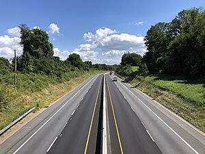
The Pennsylvania Turnpike, also known as I-76, is a major highway. It runs through the middle of the township. Pennsylvania Route 100 also goes through the eastern part of the township. Pennsylvania Route 401 crosses the northeastern corner of the township.
Places to Worship
There are several places of worship in Upper Uwchlan Township. Windsor Baptist Church was founded in 1833. It is located in the village of Eagle. Saint Elizabeth is a Catholic church. It is located on Fellowship Road. Just south of it, on Pottstown Pike, is Beth Israel Congregation of Chester County. This is the only synagogue in Upper Uwchlan.
See also
 In Spanish: Municipio de Upper Uwchlan para niños


