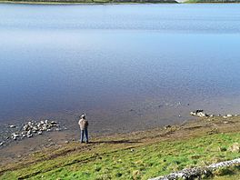
Urlaur Lough facts for kids
Quick facts for kids Urlaur Lough |
|
|---|---|
 |
|
| Location | County Mayo |
| Coordinates | 53°50′46″N 8°44′31″W / 53.84611°N 8.74194°W |
| Primary outflows | River Lung |
| Catchment area | 13.6 km2 (5.3 sq mi) |
| Basin countries | Ireland |
| Max. length | 2.8 km (1.7 mi) |
| Max. width | 0.5 km (0.3 mi) |
| Surface area | 1.15 km2 (0.44 sq mi) |
| Average depth | 4 m (13 ft) |
| Max. depth | 11 m (36 ft) |
| Surface elevation | 81 m (266 ft) |
Urlaur Lough is a beautiful freshwater lake located in the west of Ireland. You can find it in the eastern part of County Mayo, and it's one of a group of lakes known as the Urlaur Lakes.
Contents
Where is Urlaur Lough?
Urlaur Lough is quite long, stretching about 3 kilometers (almost 2 miles). It's also about 0.5 kilometers (half a mile) wide.
This lake is located about 10 kilometers (6 miles) north of a town called Ballyhaunis. It's close to two other lakes, Lough Nanaoge and Lough Roe, which are also part of the Urlaur Lakes.
How Water Flows Through Urlaur Lough
Urlaur Lough is an important source of water for the Lung River. The Lung River starts here and then flows onward to another larger lake called Lough Gara. This connection helps water move through the local area.
Amazing Animals of Urlaur Lough
Urlaur Lough is home to many different kinds of fish and birds. It's a great place to see wildlife!
Fish in the Lake
You can find several types of fish swimming in Urlaur Lough. These include perch, roach, and pike. There are also smaller fish like the ninespine stickleback.
One very special fish found here is the European eel. This eel is critically endangered, which means it's in great danger of disappearing forever. Protecting lakes like Urlaur Lough helps keep these important creatures safe.
Birds Around the Water
Many different bird species visit or live around Urlaur Lough. You might spot tufted ducks and pochards, which are types of diving ducks.
Other birds include the teal, a small dabbling duck, and the common mallard. In winter, you might see large whooper swans. Wigeons and curlews also make their home near the lake.
A Special Protected Area
Urlaur Lough is part of something called a Special Area of Conservation. This means the area is protected by law because it has important natural habitats and species. It helps make sure the lake and its wildlife stay healthy for a long time.
 | Janet Taylor Pickett |
 | Synthia Saint James |
 | Howardena Pindell |
 | Faith Ringgold |


