
Usway Burn facts for kids
Quick facts for kids Usway Burn |
|
|---|---|

Young trees in the Usway Burn valley
|
|

Location within Northumberland
|
|
| Country | United Kingdom |
| County | Northumberland |
| Physical characteristics | |
| River mouth | 55°21′46″N 2°10′50″W / 55.362788°N 2.180575°W |
The Usway Burn is a beautiful river found in the Northumberland National Park in England. It flows through the southern part of the Cheviot Hills. This river is about 15 kilometers (9 miles) long. It eventually joins another river called the River Coquet. The Usway Burn is also near the start of the famous long-distance walking path, the Pennine Way.
Contents
Exploring the Usway Burn
The Usway Burn is an important river in the Northumberland National Park. It is known for its clear waters and the peaceful valleys it flows through. The river starts high up in the hills and makes its way down to join a larger river.
Where Does it Flow?
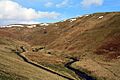
The Usway Burn begins its journey with several smaller streams joining together. Some of these streams come from the hills far to the north.
- Northern Streams: Two streams called Coldwell Strand and Shedding Sike drain from Cairn Hill. This hill is a part of The Cheviot range. These are the Usway Burn's most northern beginnings.
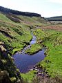
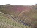
- Western Streams: Further south, Davidson's Burn and Tod Sike join the Usway Burn. These streams start very close to the border with Scotland. Davidson's Linn is a waterfall on Davidson's Burn. It was admired by travel writers in the 20th century.
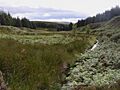
- Eastern Streams: The Clay Burn is a stream that joins the Usway Burn from the east. It collects water from streams near Bloodybush Edge hill.
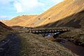
Uswayford: A Remote Spot
As the river flows south, it passes by Uswayford. This is the most northern settlement along the Usway Burn. It is located near a hill called Hazely Law. Uswayford has a farm and used to have a quarry. It's a very quiet and remote place.
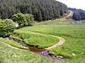
The River's Journey South
Further down, the Usway Burn flows through less forested areas. It runs parallel to another stream called Hepden Burn for a few miles. Hepden Burn eventually meets the River Coquet.
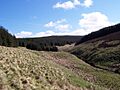
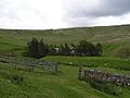
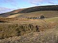
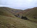
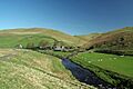
The Usway Burn continues its journey south past places like Fairhaugh House & Estate and Batailshiel Haugh Farm. These are located between Saughy Hill and Shillhope Law, which are both hills about 500 meters high. About two miles further south, the Usway Burn finally meets the River Coquet at a place called Shillmoor.
Images for kids
-
Usway forest, part of the river's northern catchment area
-
Davidson's Burn tributary in the Usway Forest
-
View south from Davidson's Linn
-
The Clay Burn and Uswayford Forest
-
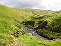
Usway Burn junction with Clay Burn (left). Sheepfold and Yarnspath Law in background
-
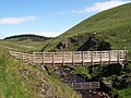
Usway Burn footbridge at Uswayford
-
The remote Uswayford Farm
-
Uswayford buildings
-
Bailey Bridge in shadow
-
Ford at Fairhaugh House
-
Batailshiel Haugh Farm
-
Southern Usway Burn and track to Batailshiel
-
Footbridge viewed from above Spit Hopes
-
Usway Burn (right) flows into the River Coquet


