
Utting, Arizona facts for kids
Quick facts for kids
Utting, Arizona
|
|
|---|---|

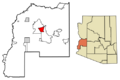
Location in La Paz County, Arizona
|
|

Utting, Arizona
Location in Arizona

Utting, Arizona
Location in the United States
|
|
| Country | United States |
| State | Arizona |
| County | La Paz |
| Area | |
| • Total | 26.60 sq mi (68.89 km2) |
| • Land | 26.60 sq mi (68.89 km2) |
| • Water | 0.00 sq mi (0.00 km2) |
| Elevation | 1,132 ft (345 m) |
| Population
(2020)
|
|
| • Total | 92 |
| • Density | 3.46/sq mi (1.34/km2) |
| Time zone | UTC-7 (Mountain (MST)) |
| ZIP code |
85325
|
| Area code(s) | 928 |
| GNIS feature ID | 24669 |
| FIPS code | 04-78400 |
Utting is a small community located in La Paz County, Arizona, in the United States. It is known as a census-designated place, which means it's an area identified by the United States Census Bureau for gathering population data. Utting is found along Arizona State Route 72 and near the Arizona and California Railroad.
The community was named after Charles Horatio Utting. He was a brave soldier who fought with the Rough Riders. The Rough Riders were a famous group of volunteer cavalry soldiers. They were led by Theodore Roosevelt during the Spanish–American War.
Contents
What is Utting Like?
Utting is a quiet place in the desert landscape of Arizona. It is located in La Paz County, which is in the western part of the state. The area is known for its wide-open spaces and desert plants.
Where is Utting Located?
Utting is situated in a part of Arizona that gets a lot of sunshine. It is about 1,132 feet (345 meters) above sea level. This elevation gives it a slightly different climate than lower desert areas.
How to Get to Utting
You can reach Utting by driving on Arizona State Route 72. This road connects it to other towns and cities. The Arizona and California Railroad also passes through the area.
Who Lives in Utting?
The number of people living in Utting is quite small. It is a close-knit community. The population changes over time, but it generally remains a small settlement.
Population Changes in Utting
According to the 2020 United States Census, 92 people lived in Utting. This is a change from the 2010 United States Census, when the population was 126. These numbers help us understand how the community is growing or shrinking.
| Historical population | |||
|---|---|---|---|
| Census | Pop. | %± | |
| 2020 | 92 | — | |
| U.S. Decennial Census | |||
Images for kids
-
Map showing Utting's location in La Paz County, Arizona
-

A robot for kids, related to the Spanish version of this article

See also
 In Spanish: Utting (Arizona) para niños
