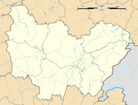
Vallery facts for kids
Quick facts for kids
Vallery
|
|
|---|---|
| Country | France |
| Region | Bourgogne-Franche-Comté |
| Department | Yonne |
| Arrondissement | Sens |
| Canton | Chéroy |
| Area
1
|
12.43 km2 (4.80 sq mi) |
| Population
(2006)
|
498 |
| • Density | 40.06/km2 (103.77/sq mi) |
| Time zone | UTC+01:00 (CET) |
| • Summer (DST) | UTC+02:00 (CEST) |
| INSEE/Postal code |
89428 /89150
|
| Elevation | 109–164 m (358–538 ft) |
| 1 French Land Register data, which excludes lakes, ponds, glaciers > 1 km2 (0.386 sq mi or 247 acres) and river estuaries. | |
Vallery is a small place in France called a commune. It is located in the Yonne department, which is in the central part of France. Think of a commune like a town or a small district.
What is a Commune?
A commune is the smallest type of administrative area in France. It's like a local government area, similar to a city, town, or village. Each commune has its own mayor and local council. They manage things like local schools, roads, and public services for the people living there.
How Big is Vallery?
Vallery is a pretty small commune. According to information from 2006, about 498 people lived there. Its total area is about 12.43 square kilometers. To give you an idea, that's roughly the size of 1,243 football fields!
Where is Vallery Located?
Vallery is found in the Yonne department. The Yonne department is part of the Bourgogne-Franche-Comté region in central France. This area is known for its beautiful countryside and historic towns. Vallery is situated between 109 and 164 meters above sea level, which means it has some gentle hills.
See also
 In Spanish: Vallery para niños
 | Emma Amos |
 | Edward Mitchell Bannister |
 | Larry D. Alexander |
 | Ernie Barnes |


