Los Algodones facts for kids
Quick facts for kids
Los Algodones, Baja California
|
|
|---|---|
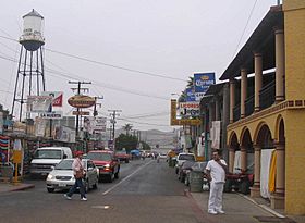
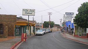
View down Calle Dos
|
|
| Country | Mexico |
| State | Baja California |
| Municipality | Municipality of Mexicali |
| Elevation | 108 ft (33 m) |
| Population
(2010)
|
|
| • Total | 5,474 |
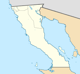
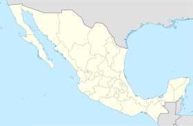
Los Algodones (pronounced "loss al-go-DOH-nes") is a small town in Baja California, Mexico. Its name means "The Cottons" in English. It's right on the border with the United States, near Andrade, California and Yuma, Arizona. In 2010, about 5,474 people lived there. Los Algodones is often called "Molar City" because it has many dentists. People from the U.S. and Canada visit to get dental care that costs less.
Contents
What's in a Name? Los Algodones' Meaning
The name Los Algodones comes from Spanish. It means "the cotton plants" in English. No one knows for sure why the town got this name.
Where in the World is Los Algodones?
Los Algodones is the northernmost town in Mexico. It's also the northernmost point in the state of Baja California. This special location means you can travel north, south, east, or west from the town and quickly reach the U.S. border.
Getting to Los Algodones
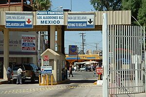
From the U.S., it's easy to reach Los Algodones. You can take Interstate 8 and then State Route 186. This road leads right to the border crossing at Andrade, California. Many visitors park their cars in Andrade and walk across the border. You can also drive across. The town is about 110 feet (33.5 meters) above sea level.
Los Algodones' Climate
| Climate data for Los Algodones (Presa Morelos) 1951–2010 | |||||||||||||
|---|---|---|---|---|---|---|---|---|---|---|---|---|---|
| Month | Jan | Feb | Mar | Apr | May | Jun | Jul | Aug | Sep | Oct | Nov | Dec | Year |
| Record high °C (°F) | 31.0 (87.8) |
34.0 (93.2) |
45.0 (113.0) |
48.0 (118.4) |
47.0 (116.6) |
49.0 (120.2) |
50.0 (122.0) |
48.0 (118.4) |
48.0 (118.4) |
45.0 (113.0) |
43.5 (110.3) |
32.0 (89.6) |
50.0 (122.0) |
| Mean daily maximum °C (°F) | 20.3 (68.5) |
22.9 (73.2) |
26.2 (79.2) |
29.7 (85.5) |
34.8 (94.6) |
39.0 (102.2) |
41.4 (106.5) |
41.0 (105.8) |
38.1 (100.6) |
32.5 (90.5) |
25.4 (77.7) |
20.3 (68.5) |
31.0 (87.8) |
| Daily mean °C (°F) | 13.1 (55.6) |
15.0 (59.0) |
17.8 (64.0) |
20.9 (69.6) |
25.6 (78.1) |
29.7 (85.5) |
33.1 (91.6) |
32.9 (91.2) |
29.8 (85.6) |
23.8 (74.8) |
17.4 (63.3) |
13.0 (55.4) |
22.7 (72.9) |
| Mean daily minimum °C (°F) | 5.8 (42.4) |
7.1 (44.8) |
9.4 (48.9) |
12.2 (54.0) |
16.4 (61.5) |
20.3 (68.5) |
24.8 (76.6) |
24.9 (76.8) |
21.5 (70.7) |
15.1 (59.2) |
9.4 (48.9) |
5.8 (42.4) |
14.4 (57.9) |
| Record low °C (°F) | −4.0 (24.8) |
−1.0 (30.2) |
0.1 (32.2) |
2.0 (35.6) |
7.0 (44.6) |
11.0 (51.8) |
13.0 (55.4) |
17.0 (62.6) |
2.0 (35.6) |
1.0 (33.8) |
0.0 (32.0) |
−5.0 (23.0) |
−5.0 (23.0) |
| Average precipitation mm (inches) | 8.7 (0.34) |
6.0 (0.24) |
4.7 (0.19) |
2.0 (0.08) |
0.5 (0.02) |
0.3 (0.01) |
3.3 (0.13) |
8.9 (0.35) |
5.5 (0.22) |
5.7 (0.22) |
4.9 (0.19) |
12.3 (0.48) |
62.8 (2.47) |
| Average precipitation days (≥ 0.1 mm) | 2.0 | 1.5 | 1.2 | 0.4 | 0.2 | 0.1 | 0.7 | 1.1 | 0.8 | 0.9 | 0.9 | 2.5 | 12.3 |
| Source: Servicio Meteorologico Nacional | |||||||||||||
Los Algodones' Economy and Tourism
Los Algodones is close to both California and Arizona. This location has made it a popular spot for tourists. People visit for affordable shopping, restaurants, and especially for medical care and medicines. The area has a warm, dry climate. This attracts many older tourists from the U.S. and Canada. They often spend their winters in nearby towns like Yuma, Arizona.
Healthcare Services in Los Algodones
Since the 1980s, Los Algodones has seen a huge growth in pharmacies, eye doctors (opticians), and dental offices. This happened because many Canadian and U.S. senior citizens come here for cheaper prescriptions and medical care. These health services have become the main focus of the town. They have replaced many of the open-air shops and restaurants that used to be right across the border.
Los Algodones has about 600 dentists. They help health tourists from Canada and the U.S. who don't have insurance. These visitors can save 40 to 60 percent on dental work. Even with all the medical services, some shops and restaurants are still open. Los Algodones also holds many fiestas (festivals) throughout the year, especially around Christmas. These events help attract more tourists.
Getting Around Los Algodones
A private bus company called Transportes Miguel Siga offers bus service between Mexicali and Los Algodones. If you are coming from the U.S. side, Yuma County Area Transit provides bus service from Andrade to Yuma.
See also
 In Spanish: Algodones para niños
 | Emma Amos |
 | Edward Mitchell Bannister |
 | Larry D. Alexander |
 | Ernie Barnes |


