Viqueque Municipality facts for kids
Quick facts for kids
Viqueque
|
|||
|---|---|---|---|
|
|||
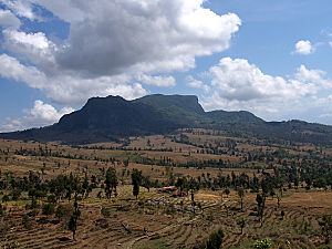
Rice fields in Viqueque
|
|||
|
|||
|
|||
|
OpenStreetMap
|
|||
| Country | |||
| Capital | Viqueque | ||
| Administrative posts |
|
||
| Area | |||
| • Total | 1,872.7 km2 (723.1 sq mi) | ||
| Area rank | 1st | ||
| Population
(2015 census)
|
|||
| • Total | 73,033 | ||
| • Rank | 5th | ||
| • Density | 38.9988/km2 (101.006/sq mi) | ||
| • Density rank | 10th | ||
| Households (2015 census) | |||
| • Total | 15,297 | ||
| • Rank | 5th | ||
| Time zone | UTC+09:00 (TLT) | ||
| ISO 3166 code | TL-VI | ||
| HDI (2017) | 0.602 medium · 9th |
||
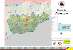
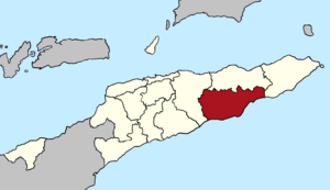
Viqueque is the largest area (called a municipality) in East Timor. It used to be known as a district. In 2010, about 77,402 people lived there, and it covers an area of 1,877 square kilometers. The main city in this municipality is also called Viqueque.
Contents
What's in a Name?
The name Viqueque comes from the local Tetun-Terik language. It can mean 'eroding water' or 'water bracelet'.
There's a cool story about the 'water bracelet' meaning. A long time ago, a brave warrior named Luka was fighting against another group of people. During his journey, he and his warriors found a spring where an old woman was guarding the water. After she gave them water, they took a bracelet from her arm. They brought the bracelet to their king, Nai Lu Leki. The king thought the bracelet was special and called it We Keke, which means 'water bracelet'.
Another story says that a queen from the Luka kingdom gave a bracelet to Viqueque as a family treasure. Today, the municipality is named after this special bracelet.
Where is Viqueque?
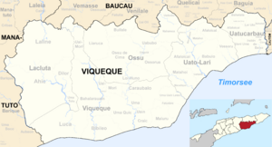
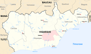
Viqueque is located on the southern coast of Timor island, right next to the Timor Sea. It shares its borders with other municipalities:
These borders have stayed the same since the time when East Timor was a colony.
How Viqueque is Organized
The Viqueque municipality is divided into smaller areas called administrative posts. These used to be called sub-districts. They are:
- Lacluta
- Ossu
- Uato-Lari (also known as Leça in the past, or Watulari in Tetum)
- Uatucarbau (also spelled Watucarbau in Tetum)
- Viqueque
These administrative posts are further divided into 35 smaller areas called sucos, which are like villages.
Who Lives in Viqueque?
Viqueque is a place where many people speak the Malayo-Polynesian language Tetum. Tetum is one of the official languages in East Timor, along with Portuguese. In the eastern part of Viqueque, some people also speak Makasae, which is a different kind of language.
See also
 In Spanish: Distrito de Viqueque para niños
 | Dorothy Vaughan |
 | Charles Henry Turner |
 | Hildrus Poindexter |
 | Henry Cecil McBay |


