Manatuto Municipality facts for kids
Quick facts for kids
Manatuto
|
||
|---|---|---|
|
||
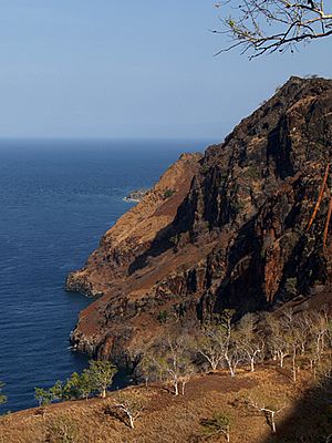
Cliffs at Manatuto
|
||
|
||
|
||
|
OpenStreetMap
|
||
| Country | ||
| Capital | Manatuto | |
| Administrative posts |
|
|
| Area | ||
| • Total | 1,783.3 km2 (688.5 sq mi) | |
| Area rank | 2nd | |
| Population
(2015 census)
|
||
| • Total | 46,619 | |
| • Rank | 13th | |
| • Density | 26.1420/km2 (67.7074/sq mi) | |
| • Density rank | 13th | |
| Households (2015 census) | ||
| • Total | 7,467 | |
| • Rank | 12th | |
| Time zone | UTC+09:00 (TLT) | |
| ISO 3166 code | TL-MT | |
| HDI (2017) | 0.614 medium · 5th |
|
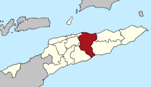
Manatuto (also called Município Manatuto in Portuguese and Munisípiu Manatutu in Tetum) is a special area, like a province, in the middle of East Timor. It's known for being the least populated municipality in the country. The main town, which is also called Manatuto, is its capital. In 2010, about 45,541 people lived here, and the area covers 1,783.3 square kilometers.
Contents
What Does Manatuto Mean?
The name Manatuto has a few interesting meanings. One idea is that it comes from the local Tetum and Galoli language word Manatutu. This word means 'pecking birds'.
Another idea is that Manatuto is a mix of two Tetum words: Mana (meaning 'old woman') and tutu (meaning 'peak' or 'summit'). A legend says that two groups of people lived on hilltops. Each group had a leader called a Liurai, who were brothers.
Manatuto's Location and Landscape
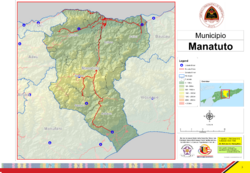
The borders of Manatuto municipality are the same as they were when East Timor was known as Portuguese Timor.
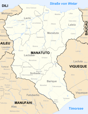
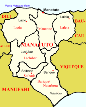
Manatuto shares its borders with several other municipalities. To the east, it's next to Baucau and Viqueque. To the west, it borders Manufahi, Aileu, and Dili.
What makes Manatuto special is that it stretches all the way from the north coast to the south coast of the island. It's one of only two municipalities in East Timor that does this. This means it has a lot of different types of land. To the north, you'll find the Strait of Wetar, and to the south, the Timor Sea.
How Manatuto is Organized
Manatuto municipality is divided into smaller areas called administrative posts. These used to be called sub-districts. Each administrative post has its own population.
Here are the administrative posts in Manatuto:
- Barique-Natarbora (around 4,900 people)
- Laclo (around 6,400 people)
- Laclubar (around 10,100 people)
- Laleia (around 3,200 people)
- Manatuto (around 11,500 people)
- Soibada (around 2,950 people)
These administrative posts are further divided into 29 smaller areas called sucos, which are like villages.
Languages Spoken in Manatuto
East Timor has two official languages: Tetum and Portuguese. In Manatuto, many people also speak Galoli, which is a Malayo-Polynesian language. The country's constitution recognizes Galoli as a "national language."
Famous People from Manatuto
Manatuto is famous for being the birthplace of Xanana Gusmão. He later became the very first president of East Timor. He was born in a village called Laleia, which is about 19 kilometers east of Manatuto town.
See also
 In Spanish: Distrito de Manatuto para niños
 | Delilah Pierce |
 | Gordon Parks |
 | Augusta Savage |
 | Charles Ethan Porter |


