Baucau Municipality facts for kids
Quick facts for kids
Baucau
|
|||
|---|---|---|---|
|
|||

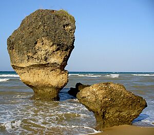
Osolata beach
|
|||
|
|||

|
|||
|
OpenStreetMap
|
|||
| Country | |||
| Capital | Baucau | ||
| Administrative Posts |
|
||
| Area | |||
| • Total | 1,504.2 km2 (580.8 sq mi) | ||
| Area rank | 4th | ||
| Population
(2015 census)
|
|||
| • Total | 123,203 | ||
| • Rank | 3rd | ||
| • Density | 81.9060/km2 (212.136/sq mi) | ||
| • Density rank | 5th | ||
| Households (2015 census) | |||
| • Total | 22,976 | ||
| • Rank | 3rd | ||
| Time zone | UTC+09:00 (TLT) | ||
| ISO 3166 code | TL-BA | ||
| HDI (2017) | 0.602 medium · 9th |
||
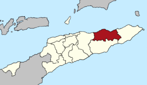
Baucau (which is Município Baucau in Portuguese and Munisípiu Baukau in Tetum) is a special area, or municipality, in East Timor. It is located on the northern coast, in the eastern part of the country. The main city of this area is also called Baucau.
In 2010, about 111,694 people lived in Baucau. The total area of the municipality is about 1,506 square kilometers.
Contents
What Does Baucau Mean?
The name Baucau comes from the word "Akau." This word means "pig" in the local Waimoa language.
During the time when Portugal ruled, the name changed. First, it was called Macau, and then it became Baucau.
There is another name for the Baucau community: Wailia-Wailewa. This means "the great water spring of Wai Lia." In the Wai Lia area, there is a large spring under big trees. It is a holy place for both traditional beliefs and Christians.
In 1936, the Portuguese rulers tried to rename the area "São Domingos." But this new name did not become popular. After World War II, it was quietly forgotten.
Where is Baucau?
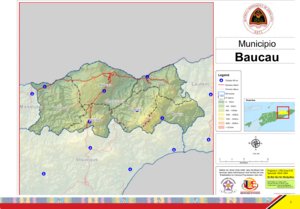
The borders of Baucau Municipality are the same as they were a long time ago. To the north, it touches the Wetar Strait. It also shares borders with other municipalities:
Baucau has a beautiful coastline with sandy beaches. These beaches are great for swimming and other water sports.
In the area called Venilale, you can find tunnels. These tunnels were built by the Japanese during World War II. Also in Venilale, there is a project to fix up an old school called Escola do Reino de Venilale.
Parts of Baucau
Baucau Municipality is divided into smaller areas called administrative posts. These used to be known as sub-districts. They are:
- Baguia
- Baucau
- Laga
- Quelicai
- Vemasse
- Venilale (This one used to be called Vila Viçosa).
People and Languages
Besides the official languages of Tetum and Portuguese, many people in Baucau speak a language called Makasae. This is a Papuan language.
Most people in Baucau are Roman Catholics. However, some Muslims also live there.
Economy and Farming
Baucau has the most developed farming in all of East Timor. Farmers grow many important crops here. These include:
- rice
- corn
- beans
- peanuts
- sweet potatoes
- copra (dried coconut meat)
- candlenut
- manioc (also known as cassava)
They also raise animals like buffalo and goats. It is sometimes hard for new businesses to grow in Baucau. This is because transportation links are not always good, and electricity can be unreliable.
Transportation
Baucau has the longest airport runway in East Timor. This airport is called Cakung Airport. It is located about six kilometers from Baucau city.
Before 1975, this airport was the main airport for the country. That changed when the Indonesian military took it over during the Indonesian invasion.
Bucoli is a village in the Baucau area. It played an important role in the resistance movement of East Timor.
Notable People
Some well-known people from Baucau include:
- Carlos Filipe Ximenes Belo
- Mário Viegas Carrascalão
- Taur Matan Ruak
See also
 In Spanish: Distrito de Baucau para niños
 | Isaac Myers |
 | D. Hamilton Jackson |
 | A. Philip Randolph |


