Vranya Pass facts for kids
Vranya Pass is a special place in Antarctica. It is an ice-covered "saddle" or low point between two higher areas. Imagine a saddle on a horse – it's a dip between two humps. Vranya Pass is 2,100 meters (about 6,890 feet) high. It separates Sullivan Heights from the huge Vinson Massif. Both of these are in the Sentinel Range of the Ellsworth Mountains in Antarctica.
This pass is also a "glacial divide." This means it's a high point where ice flows in different directions. From Vranya Pass, ice flows into Crosswell Glacier to the northwest and Hinkley Glacier to the east.
What is Vranya Pass?
Vranya Pass is like a natural pathway through icy mountains. It is covered completely in ice and snow. A "pass" or "saddle" is often used by climbers or explorers to move from one side of a mountain range to another. Even though it's a low point, it's still very high up!
Where is Vranya Pass Located?
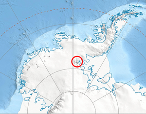
Vranya Pass is in a very cold and remote part of the world: Antarctica. Its exact center is at 78°26′33″S, 85°21′30″W.
It is located:
- About 10.9 kilometers (6.8 miles) northeast of Mount Vinson. Mount Vinson is the tallest mountain in Antarctica!
- About 8.51 kilometers (5.3 miles) east of Mount Shinn.
- About 1.74 kilometers (1.1 miles) south of Mount Segers.
- About 4.2 kilometers (2.6 miles) north-northwest of Vanand Peak.
- About 9.98 kilometers (6.2 miles) west-northwest of Mount Waldron.
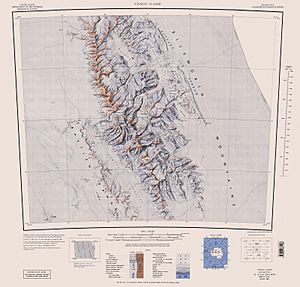
Scientists in the United States first mapped this area in 1961. They updated these maps in 1988.
Why the Name Vranya?
The name "Vranya Pass" comes from a small town. It is named after the settlement of Vranya in Southwestern Bulgaria. Many places in Antarctica are named after towns or people from different countries. This helps to honor the international efforts in exploring and studying the continent.
Maps
You can find Vranya Pass on detailed maps of the Sentinel Range. These maps show the icy landscape and the surrounding peaks.
 | Tommie Smith |
 | Simone Manuel |
 | Shani Davis |
 | Simone Biles |
 | Alice Coachman |


